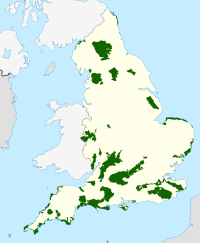
East Hampshire AONB
Template:Geobox Protected Area
East Hampshire Area of Outstanding Natural Beauty (AONB) is in Hampshire, England, UK. The southern part of the AONB is mainly rolling chalk downland used for farming that is an extension of the Sussex Downs to the east. The north and east includes steep wooded hills and heathland.
Features include; Petersfield, the Rother valley, Warnford and West Meon. Four National Nature Reserves and many several Sites of Special Scientific Interest fall within the AONB. The Hanger's Way, South Downs Way, Staunton Way and Wayfarer's Walk long distance paths pass through it.
Notable hills include Butser Hill near Petersfield, Beacon Hill and Old Winchester Hill near Corhampton and St Catherine's Hill and Cheesefoot Head near Winchester.
There was controversy in 1994 when a new stretch of the M3 motorway was cut through Twyford Down, separating St Catherine's Hill from the main AONB.

