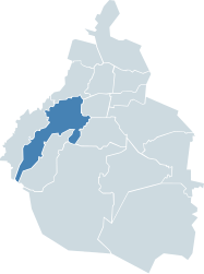
Álvaro Obregón (Delegación)
| Álvaro Obregón | ||
|---|---|---|

|
||
| Symbols | ||
|
||
| Basic data | ||
| Country | Mexico | |
| Capital district | Mexico city | |
| surface | 98.4 km² | |
| Residents | 727,034 (2010) | |
| density | 7385 inhabitants per km² | |
| founding | 1928 | |
| Website | dao.gob.mx | |
| INEGI no. | 09010 | |
| politics | ||
| Jefe delegacional | Leonel Luna Estrada | |
| Typical private street in San Ángel | ||
Coordinates: 19 ° 21 ′ N , 99 ° 14 ′ W
The Delegación Álvaro Obregón , named after the former Mexican President , is one of 16 districts ( delegaciones ) in the Mexican capital, Mexico City .
The Álvaro Obregón district was created in 1928 when the Delegaciones of Mexico City were formed. Before that, the region was called San Ángel , of which only the Colonia San Ángel , which forms part of the Delegación Álvaro Obregón, testifies to today.
Part of the Santa Fe business district also belongs to the Álvaro Obregón district , which also merges into the neighboring district of Cuajimalpa de Morelos to the west.
In addition to the actual Álvaro Obregón, the towns of Cuauhtlamila , Ampliación San Bernabé and El Ermitaño also belong to the Delegación Álvaro Obregón.
Web links
- Official website of the Delegación Álvaro Obregón (Spanish)
- Enciclopedia de los Municipios y Delegaciones de México: Delegación Álvaro Obregón (Spanish)
- INEGI : Datos Geográficos: Delegación Álvaro Obregón (Spanish; PDF)


