Iztacalco
| Iztacalco | ||
|---|---|---|

|
||
| Symbols | ||
|
||
| Basic data | ||
| Country | Mexico | |
| Capital district | Mexico city | |
| surface | 23.2 km² | |
| Residents | 384,326 (2010) | |
| density | 16,590.8 inhabitants per km² | |
| Website | iztacalco.df.gob.mx | |
| INEGI no. | 09006 | |
| politics | ||
| Jefe delegacional | Carlos Estrada Meraz | |
| The former monastery of San Matías | ||
Coordinates: 19 ° 23 '42 " N , 99 ° 5' 55" W.
With an area of 23.2 km², Iztacalco is the smallest of the 16 districts ( delegaciones ) of Mexico City .
location
Iztacalco borders in the north on Venustiano Carranza , in the extreme northwest on Cuauhtémoc , in the west on Benito Juárez , in the south on Iztapalapa and in the east on the city of Nezahualcóyotl in the state of México . The historic core of Iztacalco consists of the seven districts (Colonias) Santa Cruz, La Asunción, San Miguel, Los Reyes, Zapotla, San Francisco Xicaltongo and Santiago.
Attractions
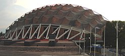
The district's attractions include the Parque Escuela Urbano Ecológico , the Centro de Desarrollo Deportivo “Magdalena Mixhuca” with the Palacio de los Deportes and the former monastery of San Matías .
Meaning of the name
The name comes from the Nahuatl and offers scope for interpretation with regard to its meaning. The most common and more likely version says that Ixtacalco means "salt house" (ixtatl = salt; calli = house; co = suffix). Other interpretations say that the name Iztacalco means "place of white houses" (iztac = white; calli = house; -co = place). The first translation with the verb "ixtatl" seems more accurate insofar as the place was originally called "Ixtacalco". The spelling did not change until the second half of the 20th century, when the words of Indian origin with an "x" in the second position were generally changed to the letter "z".
history

Due to its location on a lake in the valley of Mexico , the area of Iztacalco was settled much later than the other areas of Mexico City. Its first inhabitants were engaged in the extraction of salt, which is also addressed in the coat of arms of Iztacalco, in which the separation of water and the mineral is shown.
The place was probably one of the last places that the Aztecs reached on their way to Tenochtitlan . In the pre-Hispanic era, Iztacalco was a place under the leadership of the ruler of Texcoco , an ally of the Aztecs.
After the Spanish troops conquered Tenochtitlan, Franciscan missionaries settled in Iztacalco and built the monastery of San Matías . The population of the place was less than 300 people at the time.
Iztacalco remained a rural area until the early 20th century, characterized by gardens in which mainly flowers and vegetables were grown. The first industrial areas settled in Iztacalco in the middle of the 20th century, which soon became a popular location for various companies due to its proximity to the historic center of Mexico City. It was incorporated in 1955 and today the district is home to some of the most dangerous neighborhoods in the Mexican capital.
Web links
- Official website of the Delegación Iztacalco (Spanish)
- Enciclopedia de los Municipios y Delegaciones de México: Delegación Iztacalco (Spanish)
- INEGI : Datos Geográficos: Delegación Iztacalco (Spanish; PDF)


