Čabranka
| Čabranka | ||
|
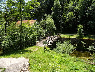
Bridge over the Čabranka |
||
| Data | ||
| location | Croatia , Slovenia | |
| River system | Danube | |
| Drain over | Kupa → Save → Danube → Black Sea | |
| source |
Gorski Kotar 45 ° 36 ′ 0 ″ N , 14 ° 38 ′ 0 ″ E |
|
| Source height | 546 m. i. J. | |
| muzzle | In the Kupa coordinates: 45 ° 31 ′ 30 ″ N , 14 ° 42 ′ 0 ″ E 45 ° 31 ′ 30 ″ N , 14 ° 42 ′ 0 ″ E |
|
| Mouth height | 287 m. i. J. | |
| Height difference | 259 m | |
| Bottom slope | 15 ‰ | |
| length | 17.5 km | |
The Čabranka is a 17.5 km long left tributary of the Kupa . For most of its course, it forms the border between Slovenia and Croatia .
Run
The Čabranka rises 546 m above sea level below the Obrh hill near Čabar in the Primorje-Gorski kotar County in Croatia, right on the border with Slovenia. It flows into the Kupa (Slovene Kolpa) at an altitude of 287 m near Osilnica.
Individual evidence
- ↑ The Čabranka Spring ( Memento from March 3, 2012 in the Internet Archive )
