Adorp
 flag |
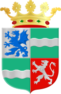
 coat of arms |
| province |
|
| local community |
|
|
Area - land - water |
18.38 km 2 18.2 km 2 0.18 km 2 |
| Residents | 860 (Jan. 1, 2017) |
| Coordinates | 53 ° 16 ' N , 6 ° 32' E |
| Important traffic route |
|
| prefix | 050 |
| Postcodes | 9738, 9771, 9774, 9893 |
| Website | Homepage of Adorp |
Adorp is a Wurtendorf in the Netherlands , which has belonged to the municipality of Het Hogeland since 2019 . Before that, Adorp was part of Winsum after it lost its independence in 1990.
Adorp is located about six kilometers north of Groningen on the foothills of the Drenther elevation on a former bend in the Selwerderdiepje . A church from the 13th century stands on the mound; the furnishings date from the 17th century. In addition, the village is home to the grain and peldemill built in 1851 , the gallery Dutch windmill Aeolus .
Web links
Commons : Adorp - collection of images, videos and audio files
- Place website (Dutch)
Individual evidence
- ↑ Kerncijfers wijken en buurten 2017 Centraal Bureau voor de Statistiek , accessed on June 30, 2018 (Dutch)