Agung (volcano)
| Gunung Agung | ||
|---|---|---|
| height | 3142 m | |
| location | Bali ( Indonesia ) | |
| Mountains | Pacific ring of fire | |
| Coordinates | 8 ° 20 ′ 31 ″ S , 115 ° 30 ′ 29 ″ E | |
|
|
||
| Type | Stratovolcano | |
| Last eruption | May 25, 2019 | |
| particularities | Active volcano | |
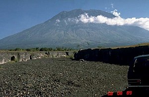
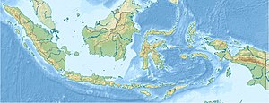
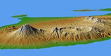
The Agung ( Indonesian Gunung Agung , from gunung "mountain" and agung "big, great") is an active stratovolcano on the Indonesian island of Bali and the highest point on the island. Nearly 1,600 people died in an outbreak in 1963.
Mythological meaning
The Gunung Agung was considered a holy mountain even before the introduction of Hinduism . On the southwest flank there was a sanctuary at an altitude of about 900 meters for the worship of the mountain and the ancestral spirits who lived here . Later this sanctuary was taken over by Hinduism and the Pura Besakih temple was built on the same site and is still in use today.
The Gunung Agung is often seen as a symbol of the mythological mountain Meru and thus the center of the world. This mountain cult is mixed with the worship of Shiva , especially in his form as the sun god Surya , and with an ancestral cult . The Pura Besakih contains several altars , shrines and valuable statues and is the tallest Hindu sanctuary in Bali. The mountain is climbed in religious ceremonies in order to collect holy water in palm leaves, with which the pilgrims are then wetted.
Ascent
There are three ways the mountain can be climbed: from the south, southeast, and west. The path to the west is the usual ascent path. It begins at the mother temple Pura Besakih . It is important for hikers to bring their own water with them, as the only source on the way is sacred and its use is therefore prohibited (depending on the tourist frequency, there are also water sellers on the summit).
From the top of the volcano you can see the top of Gunung Rinjani on Lombok Island ; however, both volcanoes are often shrouded in clouds. The best time to arrive at the summit is daybreak, as it is mostly cloud-free at this time and the views are not impaired.
Geology, historical eruptions
Mount Agung is a cone-shaped stratovolcano made of andesite and andesitic basalt. It was created by subduction of the oceanic crust. Its central crater is to the west of the highest point, it measures 500 meters in diameter and is 200 meters deep. The eruptions so far have often been explosive. The volcano erupted three times in the 19th century. Little is known about the previous eruptions. According to more recent estimates, the eruption of 1843 had the volcanic explosion index VEI = 5 (earlier estimate VEI = 2). On average, the eruptions of the volcano have VEI = 2 to VEI = 3. However, 25% of the eruptions can be similar or even larger than the eruption of 1963 with VEI = 5.
There are numerous rice fields and other agricultural uses in the immediate vicinity. The population is dependent on the agricultural yield, they feed themselves largely from their own cultivation. Every eruption represents an existential threat. This is compounded by the lack of tourism in the event of a volcanic eruption.
Eruption in 1963, 1964
The eruption from 1963 to 1964 with the volcanic explosion index VEI = 5 was the strongest volcanic eruption in Indonesia since the eruption of Krakatau in 1883. It began on February 18 with smaller explosions in the summit crater. A few days later, a lava flow from the crater flowed north, which reached a length of 7.5 kilometers. At the same time, pyroclastic currents were moving down the northern slope. On March 17, there was a violent eruption in which an eruption column rose an estimated 19 to 26 kilometers high. Volcanic ash was mainly distributed to the west and northwest and was still detectable in Jakarta, just under 1000 kilometers away . Pyroclastic currents with a length of up to 14 kilometers tumbled down the south and south-east slopes of the Agung; by far most of the people killed that day died from them. Since the outbreak fell in the rainy season on Bali, cold and hot lahars formed , some of which reached the coast. A second, weaker eruption on May 16 resulted in an eruption column about 20 kilometers high and further deaths. In Pura Besakih , most of the buildings in the temple complex were destroyed by an earthquake measuring 6.0 (Richter scale) on May 18 . Lapilli had already fallen on the plant beforehand . Between May 1963 and January 1964 there were further, weakening eruptions. The rainy season, which began in November, mobilized deposits of pyroclastic currents, causing further lahars to appear. As a result of the eruption, the wreck of the USAT Liberty , which had been lying on the beach in Tulamben in northern Bali since 1942, was pushed into the sea, where it has been around 30 meters deep since then.
A total of 1148 people were killed and 624 injured and 540 km² of agricultural area, 185 km² of forest and many villages were destroyed. The Volcanological Survey of Indonesia , the Indonesian authority responsible for volcano monitoring, called on March 13th to evacuate the area around the Agung. According to volcanologists , the evacuation was implemented hesitantly by the government of the island of Bali. Many residents did not leave the danger zone because of important religious ceremonies on March 17th. Another reason given for the high number of deaths is the long absence of severe volcanic eruptions in Bali, which meant that people were not aware of the possible dangers.
The volcanic eruption released around 7 million tons of sulfur dioxide and carried it into the stratosphere , where it was mainly distributed over the southern hemisphere due to the seasonal wind directions . Sulfur-containing aerosols have been detected in Australia, among other places. According to later evaluations, the average temperature in the tropical troposphere temporarily decreased by 0.5 ° C, while the temperature in the stratosphere increased by several degrees. On the basis of the data obtained, the first climate model was set up to describe the influence of volcanic eruptions on temperature.
Eruption 2017/2018
2017
At the end of September 2017, the authorities in Bali reported increased seismic activity from the volcano. According to reports in the international press, around 120,000 residents had left the region around the volcano by September 28, 2017, after the warning level for a possible eruption had been raised several times within a week. On October 29, 2017, the highest warning level was lifted and some of the residents were able to return to their homes.
The first eruption with VEI = 2 began on November 25, 2017. On the evening of November 26, the tremor increased, a column of ash and steam condensate stood up to four kilometers above the crater, and a fire glow was over the night from afar seen the mountain and ash particles rained down on the surrounding areas. After another significant increase in tremor, the warning level was reset to red on November 27 at 6 a.m. (local time). Flight operations were suspended and around 59,000 passengers were stuck in the airport. The authorities extended the evacuation zones to 8 to 10 kilometers and warned of possible pyroclastic currents and, because of the beginning of the rainy season in Bali , of lahars . On November 27, films and pictures were shown in the media showing lahars that reached far into the landscape around the volcano.
In the following rainy days, a violent tremor that lasted about an hour occurred once or twice a day. It is not certain whether this was caused by paroxysmal eruptions in the crater area or by lahars. In between there were small micro-tremors. Inflation was measured at several points on the crater . The lava that flowed into the crater formed a shallow lava dome that filled about a third of the crater. The tough lava clogged the extraction vent. On December 9th, photos of a volcanologist appeared for the first time, who risked a lot on his own ascent to the crater. A longer phase followed with brief ash ejections from cracks in the center of the lava dome. A few clouds of ash reached a height of more than 2000 meters above the crater. During one of these events, lapilli about a millimeter in diameter rained on the village of Temakung . At the same time, the seismogram showed a clear amplitude for each of these mini-eruptions.
2018
On January 11th, 15th and 19th there were short, explosive eruptions with an ejection of ash. During the strongest explosion, during the night of January 19th, glowing tephra was hurled several hundred meters high. This was followed by a relatively quiet phase. In response, the authorities lowered the warning level from red to orange on February 10. On February 13, the volcano erupted again around noon, a mighty column of ash up to five kilometers high stood over the mountain. Due to another ash ejection, flights to and from Bali and Lombok were briefly canceled on June 28, 2018. There is a four-kilometer restricted zone around the mountain (as of June 30, 2018).
On July 2, 2018 at 9:04 p.m. WITA, Mount Agung erupted again. Lava was distributed in a radius of 2 km. The height of the ash column was approx. 2,000 m.
literature
- Stephen Self, Michael R. Rampino: The 1963–1964 eruption of Agung volcano (Bali, Indonesia). In: Bulletin of Volcanology , 2012 (74), pp. 1521-1536 doi : 10.1007 / s00445-012-0615-z .
Web links
- Agung in the Global Volcanism Program of the Smithsonian Institution (English)
- Volcanic eruption in Bali - ash rain and lahars on the Agung. Knowledge platform Earth and Environment, eskp.de, undated (November / December 2017)
- Current volcanic crisis on Mount Agung. Knowledge Platform Earth and Environment, eskp.de, November 29, 2017
Individual evidence
- ↑ Volcano erupted in Bali: Mount Agungs erupted again. ZDF , April 21, 2019, accessed on April 22, 2019 .
- ↑ Thousands fled from the impending volcanic eruption in Bali. In: orf.at. November 22, 2017. Retrieved November 22, 2017 .
- ^ Karl Gratzl: Myth Mountain. Lexicon of the important mountains from mythology, cultural history and religion . Hollinek, Purkersdorf 2000, ISBN 3-85119-280-X .
- ↑ The Sacred Mountain - G. AGUNG, Bali , volcanohotspots.wordpress.com, accessed on July 31, 2019 at: [1]
- ↑ Gunung Agung - Mountain of Ancestors , www.vulkane.net, accessed on July 31, 2019 at: [2]
- ↑ Significant Earthquakes in INDONESIA, NOAA, accessed on July 31, 2019 at: [3]
- ↑ Self, 1963–1964 eruption , pp. 1521–1524; MT Zen, Djajadi Hadikusumo: Preliminary report on the 1963 eruption of Mt Agung in Bali (Indonesia). In: Bulletin Volcanologique , 27 (1964) pp. 269-299.
- ^ Agung in The Significant Volcanic Eruption Database of NOAA (accessed February 7, 2013).
- ^ Zen, Preliminary report , p. 286.
- ^ Zen, Preliminary report , p. 287.
- ↑ Stephen Self: Effects of volcanic eruptions on the atmosphere and climate. In: Joan Martí, Gerald Ernst (Eds.): Volcanoes and the environment. Cambridge University Press, Cambridge 2005, ISBN 978-0-521-59254-3 , pp. 152-174, here p. 157.
- ↑ Mount Agung is seething in Bali: 34,000 residents had to flee Der Standard, September 24, 2017
- ^ The Guardian, Sept. 22, 2017: Bali on high alert after tremors around Mount Agung volcano.
- ↑ Signs of an outbreak are more orf.at, September 28, 2017, accessed September 28, 2017.
- ↑ Bali lowers alert level for volcanic eruption orf.at, October 29, 2017, accessed October 29, 2017.
- ↑ Blog entries on vulkane.net from November 25th and 26th, 2017, on: [4]
- ↑ Agung volcano emits clouds of smoke and ash four kilometers high . In: nzz.ch, November 26, 2017, accessed on November 26, 2017.
- ↑ Eliott C. McLaughlin, Mochamad Andri, Ben Westcot: Indonesia volcano: Mount Agung eruption closes Bali's main airport , published on CNN-Online, accessed at: [5]
- ↑ Ir. Kasbani: Peningkatan Status Gunungapi Agung, Bali Dari Level Ill (SIAGA) ke Level IV (AWAS) , retrieved from: [6]
- ↑ Aurora Bosotti: Bali volcano: Indonesia disaster agency warns of COLD LAVA flows after Mount Agung erupts , on express.co.uk, from November 27, 2017.
- ↑ Seismogram of the VSI, accessed November 28, 2017 to January 4, 2018 at: [7] and various VSI press releases.
- ↑ Blog entries on vulkane.net from December 4th to 30th, 2017, on: [8]
- ↑ Active volcano in Bali: dozen flights canceled. orf.at, June 29, 2018.
- ↑ Airports open again - still volcanic arm on Bali. orf.at, June 30, 2018
- ↑ Gunung Agung Meletus Lava Terlontar 2 km from Membakar Hutan , "detik.com", 3 July 2018.


