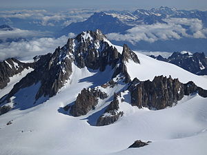
Aiguille du Tour
| Aiguille du Tour | ||
|---|---|---|
|
Aiguille du Tour seen from the Aiguille du Chardonnet |
||
| height | 3540 m above sea level M. | |
| location | Canton of Valais , Switzerland / Haute-Savoie , France | |
| Mountains | Mont Blanc group | |
| Dominance | 2.1 km → Grande Fourche | |
| Notch height | 259 m ↓ Col du Tour | |
| Coordinates , ( CH ) | 45 ° 59 '40 " N , 7 ° 0' 37" O ( 566812 / 93738 ) | |
|
|
||
| First ascent | August 1875 by G. and E. Beraneck and E. Javelle | |
| Normal way | East flank and north ridge to the south summit, I and II, ice 35 °, F | |
|
Aiguille du Tour, balloon shot by Eduard Spelterini |
||
The Aiguille du Tour is a 3540 m high mountain that marks the border between Switzerland and France with its two peaks of about the same height . (According to other information, the north summit reaches a height of 3544 m and the south summit 3542 m .) The Aiguille du Tour is located between the Tour glacier ( Glacier du Tour ) on the French side in the west and the Trient glacier (Plateau du Trient) on the Valais side in the East.
It is flanked by the Aiguille du Pissoir ( 3440 m above sea level ) in the north and the Aiguille Purtscheller ( 3475 m above sea level , named after Ludwig Purtscheller , the first to climb this needle) in the south.
First ascent
The first ascent of the south summit took place on August 18, 1864 by CG Heathcote and Moritz Andermatten, that of the somewhat higher north summit in August 1875 by G. and E. Beraneck and E. Javelle.
swell
- ↑ a b c Hartmut Eberlein: Area Leader Mont Blanc Group . Bergverlag Rudolf Rother, Munich 1991. ISBN 3-7633-2412-7
- ↑ swisstopo PK25
- ↑ map.geo.admin.ch map.geo.admin.ch


