Albuen
| Albuen | ||
 Albuen as a separate island on a map from around 1900 |
||
| Geographical location | ||
|
|
||
| Coordinates | 54 ° 49 '45 " N , 10 ° 57' 35" E | |
| Waters 1 | Langelandsbelt | |
| Waters 2 | Nakskovfjord | |
| surface | ||
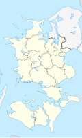
Albuen (from Danish Albue = elbow) is an uninhabited peninsula on the western tip of the Danish island of Lolland between the Nakskovfjord and the Great Belt since the late 1960s . It has an area of 720.6 hectares and is connected to Lolland by a 5 km long and 20 to 200 meter wide headland called Dragene . On old nautical charts it can be seen that Albuen was still an island at the beginning of the 20th century . On Albuen there is a lighthouse for navigation in the Langelandsbelt. The fire was shut down in 2016.
Albuen belongs to the parish community ( Danish : Sogn ) Kappel Sogn , which until 1970 belonged to Harde Lollands Sønder Herred in the Maribo office , since then to the Rudbjerg municipality in the former Storstrøms office , which became part of the Lolland municipality in the course of the municipal reform on January 1, 2007 the Sjælland region has risen.
Individual evidence
- ↑ a b Danmarks Statistics: Statistisk Aarbog 1920 - Table 3: Arealets Fordeling paa de forskellige større og mindre Landsdele including Folkemængde og Befolkningstæthed on February 1, 1916, footnote 6 (Danish / French; PDF; 1.1 MB)
- ↑ www.statistikbanken.dk → Befolkning og valg → Folketal → Table BEF4: Folketal pr. January 1, demands på øer , accessed on September 20, 2009
