Aldan highlands
| Aldan highlands | ||
|---|---|---|
| Highest peak | nameless ( 2306 m ) | |
| location | at Aldan ; Republic of Sakha (Yakutia), Siberia ( Russia , Asia ) | |
| part of | South Siberian Mountains | |
|
|
||
| Coordinates | 57 ° 5 ' N , 127 ° 59' E | |
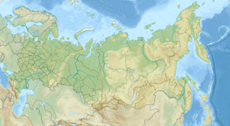
The Aldan highlands ( Russian Алданское нагорье , scientific transliteration Aldanskoe nagor'e ; also called Aldan mountains ) near Aldan in the Republic of Sakha (Yakutia), Siberia ( Russia , Asia ) is a high mountain range of the South Siberian Mountains up to 2306 m high .
Geographical location
The Aldan highlands are located in the south of the Sakha Republic and border the Stanowoy Mountains in the south . It is bounded in the north by the Aldan River , which it partially crosses like the Amga, which rises in the western part of the highlands . In the highlands there is the town of Aldan a little south of the Aldan and the town of Tschulman in the south of the landscape . In the west the highlands meet the valley of the Oljokma , in the southwest, south and southeast of the Stanowoi Mountains, in the southeast of the valley of the Gonam , in the east of that of the Uchur and in the northeast of the confluence of the Uchur in the Aldan.
traffic
Coming from the Central Yakut lowlands from Nizhny Bestjach , which is far in the northeast near Jakutsk an der Lena , the M56 trunk road leads through the Aldan highlands mainly in a north-south direction from Tommot (am Aldan) through Aldan (am Seligdar ), Tschulman (am Tschulman ) , Serebrjany Bor (on the Gorbyllach tributary Olongoro ) - there a little east past Nerjungri (on the Tschulman) - and Berkakit (on the Tschulman tributary Kleine Berkakit ) to Tynda (on the Tynda ) south of the Stanovoi Mountains .
Individual evidence
- ↑ Article Aldan Highlands in the Great Soviet Encyclopedia (BSE) , 3rd edition 1969–1978 (Russian)
