
Almbach (Gleißenbach)
| Almbach | ||
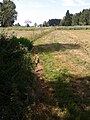
 The Almbach after leaving the Aufhofener Weiher |
||
| Data | ||
| location | Bad Tölz-Wolfratshausen district | |
| River system | Danube | |
| Drain over | Inflow ditch → Gleißenbach → Hachinger Bach → Hüllgraben → Abfanggraben → Mittlere-Isar-Kanal → Isar → Danube → Black Sea | |
| source | north of Aufhofen 47 ° 56 '23 " N , 11 ° 31' 42" E |
|
| Source height | over 645 m above sea level NHN | |
| muzzle | underground in the inlet ditch of the Deininger pond
|
|
The Almbach is a body of water almost three kilometers long near Aufhofen and Dettenhausen in the municipality of Egling in the Bad Tölz-Wolfratshausen district , which mostly seeps away.
course
The Almbach rises a little before the northern outskirts of Aufhofen on the way to the Josefikapelle and initially runs roughly west. After about 150 meters it already flows into the Aufhofener Weiher, which dams it. The abbot of the Schäftlarn monastery had the 2.6 hectare lake built as a fishing water in 1721/22. On the west side, the Almbach leaves the pond through two locks and flows into the adjacent wooded tip of Kastenich , in which the two outlets soon meet. Back in the hallway, he runs more and more to the southwest and in the process crosses a pipe under the road from Aufhofen to Dettenhausen. Beyond in the Langes Moos meadow it disappears after a quarter of a kilometer in a pipeline that leads it at a right angle for almost 200 meters to the right and northwest, where it reappears close to a tree-lined former small pond and runs north back to the road.
Its long piping begins at the edge, leading it underground to the inflow ditch , today's main inflow of the Deininger Weiher .
In earlier times, the Almbach meandered through the Deininger Filz approximately northwards down the meadows to the Deininger Weiher, where it was called Gleißenthalbächel after the long dry valley Gleißental stretching northeast to Deisenhofen . Its outflow, known today as Gleißenbach , also seeps away a little below the lake, which is also known as Gleißentalweiher . The dry valley then drains below the Hachinger Bach .
Almbach from the source to the entrance to the Aufhofener Weiher

Almbach to the pipe penetration under the Aufhofen-Dettenhausen road
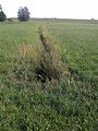
Almbach between the piped routes
.jpg)
.jpg)
.jpg)