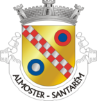
Almoster (Santarém)
| Almoster | ||||||
|---|---|---|---|---|---|---|
|
||||||
| Basic data | ||||||
| Region : | Alentejo | |||||
| Sub-region : | Lezíria do Tejo | |||||
| District : | Santarém | |||||
| Concelho : | Santarém | |||||
| Coordinates : | 39 ° 15 ′ N , 8 ° 48 ′ W | |||||
| Residents: | 1818 (as of June 30, 2011) | |||||
| Surface: | 40.82 km² (as of January 1, 2010) | |||||
| Population density : | 45 inhabitants per km² | |||||
| Postal code : | 2005-111 | |||||
| politics | ||||||
| Mayor : | João de Oliveira Neves ( PPD / PSD ) | |||||
| Address of the municipal administration: | Junta de Freguesia de Almoster Largo do Mosteiro 2005-111 Almoster |
|||||
Almoster is a town and municipality in Portugal .
history

“The Resurrection”, painting by Diogo de Contreiras from the monastery church of Almoster, now part of the collection of the Museu Nacional de Arqueologia
|
The traces of human settlement go back about 5,000 years, to the Copper Age and the Early Bronze Age . The finds made here are now part of the collection in the Museu Nacional de Arqueologia .
The place name is derived from a small monastery that may have existed here earlier, so that the place name developed from the Arabic article al and the Latin word for monastery ( monasterium , Portuguese: mosteiro ). Historians like Raul de Carvalho believe this theory may not be correct.
Much later, in 1287, the Cistercian Abbey of Almoster was founded here. Only a few parts of it have been preserved and are now a listed building, including the church.
In the course of the Miguelista War, a battle took place on February 18, 1834 near the municipality of Santa Maria (today Casal da Charneca), known as Batalha de Almoster . The troops of the absolutist King D. Miguel I under General Lemos were subject to General Saldanha , who led the troops of the liberal ex-King D. Pedro IV , the first emperor of Brazil .
administration
Almoster is the seat of the municipality of the same name ( Freguesia ) in the district ( Concelho ) of Santarém . 1818 inhabitants live in it on an area of 41 km² (as of June 30, 2011).
The following localities are in the municipality:
|
|
Web links
- Website on the municipality of Almoster at the municipality of Santarém
- Profile of the municipality of Almoster in the Mapas de Portugal
- Website of the Associação Recreativa e Cultural da Freguesia de Almoster (ARCFA) (as blog)
- Roteiro Almoster , website about the municipality of Almoster (as blog)
Individual evidence
- ↑ a b www.ine.pt - indicator resident population by place of residence and sex; Decennial in the database of the Instituto Nacional de Estatística
- ↑ Overview of code assignments from Freguesias on epp.eurostat.ec.europa.eu
- ↑ a b c Historical data on the website of the municipality of Almoster ( Memento of the original from December 3, 2016 in the Internet Archive ) Info: The archive link has been inserted automatically and has not yet been checked. Please check the original and archive link according to the instructions and then remove this notice. at the Santarém district administration, accessed on November 29, 2016
- ↑ João Fonseca: Dicionário do Nome das Terras 2nd edition, Casa das Letras, Cruz Quebrada 2007, page 28.


