
Santarém (Portugal)
| Santarém | ||||||
|---|---|---|---|---|---|---|
|
||||||
| Basic data | ||||||
| Region : | Alentejo | |||||
| Sub-region : | Lezíria do Tejo | |||||
| District : | Santarém | |||||
| Concelho : | Santarém | |||||
| Coordinates : | 39 ° 14 ′ N , 8 ° 41 ′ W | |||||
| Residents: | 61,752 (as of June 30, 2011) | |||||
| Surface: | 552.54 km² (as of January 1, 2010) | |||||
| Population density : | 112 inhabitants per km² | |||||
| Santarém district | ||||||
|
||||||
| Residents: | 61,752 (as of June 30, 2011) | |||||
| Surface: | 552.54 km² (as of January 1, 2010) | |||||
| Population density : | 112 inhabitants per km² | |||||
| Number of municipalities : | 18th | |||||
| administration | ||||||
| Administration address: | Câmara Municipal de Santarém Praça do Município 2005-245 Santarém |
|||||
| President of the Câmara Municipal: | Ricardo Gonçalves Ribeiro Gonçalves ( PSD ) | |||||
| Website: | www.cm-santarem.pt | |||||


Santarém is a city in Portugal . It is the capital of the Santarém district .

history
Finds show a settlement since the late Bronze Age . Phoenicians , Greeks and other peoples came to trade across the Tagus to this point. In 138 BC Chr. The city under the name Scalabis was first as a Roman documented village. The then further fortified city, later called Scalabis Castro, located in the central Tejo area, became an important administrative and commercial city of the Roman province of Lusitania .
After the invasion of the Alans and the Vandals , the place was called Santa Irene in the 5th century AD. From the time of Sunerico's conquest in 460 , the city belonged to the Visigoth Empire until the Moors conquered it in 715 . In the course of the following Reconquista , Santarém was also contested. Henry of Burgundy , Count of Portucale , conquered the city at the end of the 11th century. It was recaptured by the Arabs in 1110 . Under Portugal's first king, D.Afonso Henriques , Santarém finally became Portuguese on March 15, 1147 . The changing history of the city can be seen in the listed town center. The historic city center is the largest contiguous old town in the country with an area of almost 2 square kilometers.
Santarém supported the Portuguese heir to the throne António von Crato in 1580 . After his unsuccessful efforts and the subsequent personal union of Portugal with Spain, the city felt some neglect and there were various uprisings, for example in 1629 , 1636 and 1637 . After the damage caused by the Lisbon earthquake in 1755 and the Napoleonic invasions at the beginning of the 19th century, the city then experienced some urban improvements. In 1868 the previous small town ( Vila ) was elevated to a town ( Cidade ). In 2000 the Ponte Salgueiro Maia bridge was built over the Tagus.

Torre das Cabaças

In the old City

At the W Shopping mall

In the historic town center
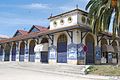
The municipal market halls Mercado Municipal


administration
Since 2002 Santarém has been included in the statistical region of Alentejo and the statistical sub-region of Lezíria do Tejo , but still belongs to the developing region ( Comissão de Coordenação e Desenvolvimento Regional ) Lisbon, which, based on the historical province , bears the name Lisboa e Vale do Tejo .
Santarém is the capital of the Santarém district .
Santarém district
Santarém is the administrative seat of a district of the same name ( concelho ). On June 30, 2011 the district had 61,752 inhabitants on an area of 552.5 km².
The neighboring areas are (starting clockwise in the north): Porto de Mós , Alcanena , Torres Novas , Golegã , Chamusca , Alpiarça , Almeirim , Cartaxo , Azambuja , Rio Maior and Alcobaça .
With the regional reform in September 2013 , several municipalities were merged into new municipalities, so that the number of municipalities decreased from 28 to 18.
The following municipalities ( freguesias ) are in the Santarém district:

| local community | Population (2011) |
Area km² |
Density of population / km² |
LAU code |
|---|---|---|---|---|
| Abitureiras | 972 | 23.69 | 41 | 141601 |
| Abrã | 1,122 | 22.44 | 50 | 141602 |
| Achete, Azoia de Baixo e Póvoa de Santarém | 2,923 | 44.26 | 66 | 141629 |
| Alcanede | 4,547 | 105.84 | 43 | 141604 |
| Alcanhões | 1,469 | 11.45 | 128 | 141605 |
| Almoster | 1,818 | 40.82 | 45 | 141606 |
| Amiais de Baixo | 1,851 | 6.30 | 294 | 141607 |
| Arneiro das Milhariças | 835 | 12.02 | 69 | 141608 |
| Azoia de Cima e Tremês | 2,477 | 33.29 | 74 | 141630 |
| Casevel e Vaqueiros | 1,149 | 36.78 | 31 | 141631 |
| Gancaria | 514 | 5.59 | 92 | 141628 |
| Moçarria | 1,136 | 12.12 | 94 | 141613 |
| Pernes | 1,446 | 14.06 | 103 | 141614 |
| Póvoa da Isenta | 1,127 | 13.90 | 81 | 141616 |
| Romeira e Várzea | 2,600 | 32.45 | 80 | 141632 |
| Santarém (Marvila), Santa Iria da Ribeira de Santarém, Santarém (São Salvador) e Santarém (São Nicolau) | 29,929 | 55.51 | 539 | 141633 |
| Sao Vicente do Paul e Vale de Figueira | 2,917 | 71.82 | 41 | 141634 |
| Vale de Santarém | 2,920 | 10.20 | 286 | 141625 |
| Santarém district | 61,752 | 552.54 | 112 | 1416 |
Population development
| Population in Santarém County | |||||||||
|---|---|---|---|---|---|---|---|---|---|
| year | 1801 | 1849 | 1900 | 1930 | 1960 | 1981 | 2001 | 2008 | 2011 |
| Residents | 37,304 | 15,425 | 41,994 | 54,701 | 63,777 | 62,896 | 63,563 | 63,630 | 62,162 |
Municipal holiday
- 19th March
Town twinning
City friendships
|
Cooperation agreementIn preparation
|
economy
In the Santarém district, the industry is particularly represented in the fields of ceramics, food processing and wood processing, but also with metalworking, chemical and mechanical engineering companies, especially in the Torres Novas - Abrantes - Santarém triangle.
Santarém is the center of the historical Ribatejo province , which is still of great importance for the country for cattle breeding, vegetables, grain and fruit growing. Mention should also be made of fishing, viticulture, olive oil production and trade.
In June 2013, the 50th National Agricultural Exhibition, which was also the 60th Ribatejo Fair, took place on the exhibition grounds of the CNEMA ( Centro Nacional de Exposições e Mercados Agrícolas , German: National Center for Agricultural Exhibitions and Markets) u. a. technological, environmental and energetic problem solutions and innovations in agriculture, exhibition of machine manufacturers, etc. a. agricultural company. There is also the Salão Prazer de Provar tasting pavilion and the nature and tourism fair Expo.Tur - Feira do Turismo Rural e Natureza (German fair for rural tourism and nature). There is also a public fair with product shows, tastings, cooking events and the like. a., which is accompanied by riding events, concerts and other public events. In 2013, the trade fair attracted around 165,000 visitors annually over a three-year period.
.jpg)
traffic
The Santarém train station, just outside, is on the country's most important railway line, the Linha do Norte . In addition, the place is integrated into the national bus network of Rede Expressos .
The city is connected by the Ponte D. Luís I with Almeirim and the other parts of the country in the southeast across the Tagus and via the A15 motorway north to the nearby motorway junction with the A1 , the country's most important trunk road. To the south, after crossing the Tagus via the Ponte Salgueiro Maia , the expressway IC10 merges into the A13 , an important connection to the south of the country.
The Santarém airport is used by sports and private aircraft.
.jpg)


sons and daughters of the town
- Ibn Bassām († 1147), Islamic historian
- Ferdinand I (Portugal) (1345–1383), King of Portugal
- John of Portugal (1400–1442), Duke of Aveiro
- Ferdinand von Avis (1402–1443), Prince of Portugal
- Estácio de Sá (1520–1567), military, founder of the city of Rio de Janeiro
- Fernão Teles de Meneses (1530–1605), military, from 1581 governor of Portuguese India
- Manuel da Silva Coutinho (1541–1583), nobleman, most important supporter of the aspirant António von Crato
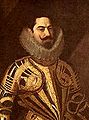
- Aires de Saldanha (1542–1605), military, from 1600 viceroy of Portuguese India
- Luis de Sousa (~ 1555–1632), Portuguese historian and writer
- António dos Reis (1690–1738), spiritual historian and writer
- Luís Cardoso (1694–1769), spiritual chronicler and historian, brother of António dos Reis
- Domingos da Encarnação Pontevel (1722–1793), Bishop of Mariana (Brazil)
- Bernardo de Sá Nogueira de Figueiredo (1795–1876), Portuguese politician and leader of the Setembrists
- António de Oliveira Marreca (1805–1889), economist, writer, Freemason and liberal politician, governor of the Azores
- Joaquim Tomás Lobo de Ávila (1822–1901), politician, economics and foreign minister until the proclamation of the republic in 1910
- Alfredo Augusto das Neves Holtreman (1837–1920), lawyer and entrepreneur
- Guilherme de Azevedo (1839–1882), journalist and poet
- António Pedro da Costa (1840–1900), Bishop of Daman
- Domingos Maria Frutuoso (1867–1949), Bishop of Portalegre
- Luiza Andaluz (1877–1973), founder of the Catholic order
- Ernestino Augusto Costa , known as Costinha (1891-1976), actor
- António Amorim de Vasconcelos Porto (1893–1956), railway engineer
- Rebelo Gonçalves (1907–1982), linguist, philologist and lexicographer, university professor and researcher
- Henrique Campos (1909-1983), director
- Armando Ginestal Machado (1913–1991), railway engineer
- Joaquim Luís Gomes (1914–2009), composer and conductor
- Bernardo Santareno (1924–1980), psychiatrist, translator and poet, most important Portuguese playwright of the 20th century.
- Leonardo Ribeiro de Almeida (1924–2006), lawyer and politician, Minister of Defense 1985–87
- Joaquim Veríssimo Serrão (* 1925), historian, author and university professor, rector of the University of Lisbon in 1973/74
- Pedro Oom (1926–1974), surrealist poet and writer
- Joaquim Magalhães Mota (1935–2007), lawyer and politician, multiple minister
- Ruy Duarte de Carvalho (1941-2010), Angolan writer, director and anthropologist
- Mário Viegas (1948–1996), actor, comedian and reciter, first celebrity to die of AIDS
- Ulisses Morais (* 1959), football coach
- João Bruto da Costa (* 1969), lawyer and politician
- Manuel de Freitas (* 1972), poet, publicist and literary critic
- Rui Silva (* 1977), Olympic athlete
- Ana Moura (* 1979), fado singer
- Inês Henriques (* 1980), Olympic track and field athlete
- Vera Santos (* 1981), Olympic track and field athlete
- Joana Amendoeira (* 1982), fado singer
- João Duarte Vieira Pereira (* 1990), football player
- João Arrais (* 1995), actor
- Maria Martins (* 1999), cyclist
Pedro Álvares Cabral , who “discovered” Brazil, who died here , is buried in the former monastery church Igreja da Graça .
Aires de Saldanha

Sá da Bandeira

Antonio de Oliveira Marreca

Alfredo Augusto das Neves Holtreman

Guilherme de Azevedo ( painted by Rafael Bordalo Pinheiro )

Rui Silva at the 2009 World Athletics Championships in Berlin

Ana Moura (2008)

Maria Martins at the UEC-Bahn-EM 2019


literature
- Thomas G. Schattner (Ed.): Archaeological guide through Portugal (= cultural history of the ancient world . Vol. 74). Philipp von Zabern, Mainz 1998, ISBN 3-8053-2313-1 p. 123
Web links
Individual evidence
- ↑ a b c www.ine.pt - indicator resident population by place of residence and sex; Decennial in the database of the Instituto Nacional de Estatística
- ↑ a b Overview of code assignments from Freguesias on epp.eurostat.ec.europa.eu
- ↑ www.verportugal.net , accessed on November 13, 2013
- ^ History of the city on the city administration website, accessed November 16, 2013
- ↑ www.verportugal.net , accessed on November 13, 2013
- ^ Publication of the administrative reorganization in the Diário da República gazette of January 28, 2013, accessed on March 16, 2014
- ↑ www.anmp.pt , accessed on November 13, 2013
- ↑ profile of the city in the online encyclopedia Pathfinder of Porto Editora (paragraph Economia ), accessed on November 16, 2013
- ^ Website of the fair , accessed on November 16, 2013
- ↑ 50th anniversary article on www.verportugal.net, accessed on November 13, 2013

Abrantes | Alcanena | Almeirim | Alpiarça | Benavente | Cartaxo | Chamusca | Constância | Coruche | Entroncamento | Ferreira do Zêzere | Golegã | Mação | Ourém | Rio Maior | Salvaterra de Magos | Santarém | Sardoal | Tomar | Torres Novas | Vila Nova da Barquinha
| ← Previous location: Azambuja |
|
Next town: Golegã → |