
Alpiarça
| Alpiarça | ||||||
|---|---|---|---|---|---|---|
|
||||||
| Basic data | ||||||
| Region : | Alentejo | |||||
| Sub-region : | Lezíria do Tejo | |||||
| District : | Santarém | |||||
| Concelho : | Alpiarça | |||||
| Coordinates : | 39 ° 16 ′ N , 8 ° 35 ′ W | |||||
| Residents: | 7702 (as of June 30, 2011) | |||||
| Surface: | 95.36 km² (as of January 1, 2010) | |||||
| Population density : | 81 inhabitants per km² | |||||
| politics | ||||||
| Address of the municipal administration: | Junta de Freguesia de Alpiarça Rua Maria Luísa Falcão, nº 30 2090-128 Alpiarça |
|||||
| Website: | www.jf-alpiarca.pt | |||||
| Alpiarça district | ||||||
|
||||||
| Residents: | 7702 (as of June 30, 2011) | |||||
| Surface: | 95.36 km² (as of January 1, 2010) | |||||
| Population density : | 81 inhabitants per km² | |||||
| Number of municipalities : | 1 | |||||
| administration | ||||||
| Administration address: | Câmara Municipal de Alpiarça R. José Relvas , 234 2090-106 Alpiarça |
|||||
| President of the Câmara Municipal: | Mário Fernando Atracado Pereira ( CDU ) | |||||
| Website: | www.cm-alpiarca.pt | |||||


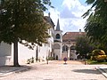
Alpiarça is a small town ( Vila ) within the Ribatejo region in Portugal .
history
The mansion Casa dos Patudos

Casa dos Patudos museum


Due to its favorable location on the left bank of the Tagus , the area was populated early on. The earliest traces of human presence come from the Paleolithic and go back to the Roman era . From its time as a small settlement in the Roman province of Lusitania , Alpiarça u. a. Coin and pottery finds. The Roman road passing here connected Olisipo (today Lisbon ) and Emerita Augusta (today Mérida ), some Roman milestones have been preserved.
The current town was probably created during the settlement policy after the Christian Reconquista . The place was officially mentioned for the first time in 1295 under the name Alpearça , which also appears in the royal surveys under D. Dinis and in a lease from 1311. In later documents the cultivation of grain and the abundance of fish in the nearby river Alpiarça (also Vala Real) are mentioned in connection with the Reguengos de Alpiarça district, a windmill marked its border with the area of Santarém, to whose jurisdiction Alpiarça belonged. Alpiarça was later incorporated into the Santarém district.
At the beginning of the 19th century floods destroyed the cultivation of grain and caused hardship among the local farmers. Queen D. Maria I then turned her attention to the region and increasingly encouraged local agriculture.
In the course of the administrative reforms after the Liberal Revolution in 1822 , Alpiarça was spun off from the Santarém district in 1836 and attached to Almeirim. In 1846, the place was subordinate to Manuel da Silva Passos and was involved in the uprising known as the revolt of Maria da Fonte ( Revolta da Maria da Fonte ). In the further course of the 19th century it became known as a place of numerous robberies and riots, and the inhabitants fell into disrepute for a time as "people of bad character" ("Alpiarça ... gente de má raça").
On February 17, 1906, Alpiarça was elevated to a small town ( Vila ). The place was known as pro-republican, and its population celebrated the proclamation of the Portuguese Republic on October 5, 1910. In 1914 Alpiarça became the seat of an independent district, which to this day only consists of its eponymous municipality.
administration
The circle

Alpiarça is the administrative seat of a district of the same name ( concelho ) in the Santarém district . On June 30, 2011 the district had 7702 inhabitants on an area of 95.4 km².
The neighboring areas are (starting clockwise in the north): Chamusca , Almeirim and Santarém .
The only municipality ( Freguesia ) in the district is Alpiarça.
Population development
| Population development of Alpiarça (1920–2011) | ||||||||
|---|---|---|---|---|---|---|---|---|
| year | 1920 | 1930 | 1960 | 1981 | 1991 | 2001 | 2004 | 2011 |
| Residents | 8591 | 7550 | 7856 | 8120 | 7711 | 8024 | 8198 | 7709 |
Municipal holiday
- 2nd of April
Town twinning
Alpiarça is in partnership with
Attractions
- The Casa dos Patudos was built from 1905 to 1909 by the architect Raul Lino for the Portuguese politician José Carlos de Mascarenhas Relvas. Today a museum is housed there.
Personalities
- José Carlos de Mascarenhas Relvas (1858–1929), politician, Prime Minister of Portugal from January 27 to March 30, 1919, died in Alpiarça.
- Abel Fontoura da Costa (1869-1940), military and politician, Republican naval minister and later agriculture minister, was born here.

Web links
- Map of the Freguesia Alpiarça at the Instituto Geográfico do Exército
- Official website of the city administration
Individual evidence
- ↑ www.ine.pt - indicator resident population by place of residence and sex; Decennial in the database of the Instituto Nacional de Estatística
- ↑ a b Overview of code assignments from Freguesias on epp.eurostat.ec.europa.eu
- ↑ a b www.ine.pt - indicator resident population by place of residence and sex; Decennial in the database of the Instituto Nacional de Estatística
- ↑ www.verportugal.net , accessed on January 21, 2014

Abrantes | Alcanena | Almeirim | Alpiarça | Benavente | Cartaxo | Chamusca | Constância | Coruche | Entroncamento | Ferreira do Zêzere | Golegã | Mação | Ourém | Rio Maior | Salvaterra de Magos | Santarém | Sardoal | Tomar | Torres Novas | Vila Nova da Barquinha