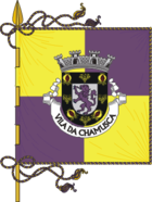
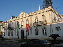
Chamusca
| Chamusca | ||||||
|---|---|---|---|---|---|---|
|
||||||
| Basic data | ||||||
| Region : | Alentejo | |||||
| Sub-region : | Lezíria do Tejo | |||||
| District : | Santarém | |||||
| Concelho : | Chamusca | |||||
| Freguesia : | União das Freguesias da Chamusca e Pinheiro Grande | |||||
| Coordinates : | 39 ° 21 ′ N , 8 ° 29 ′ W | |||||
| Postal code : | 2140-069 | |||||
| Chamusca district | ||||||
|
||||||
| Residents: | 10,120 (as of June 30, 2011) | |||||
| Surface: | 746 km² (as of January 1, 2010) | |||||
| Population density : | 14 inhabitants per km² | |||||
| Number of municipalities : | 5 | |||||
| administration | ||||||
| Administration address: | Câmara Municipal de Chamusca Edifício dos Paços do Concelho 2140-098 Chamusca |
|||||
| President of the Câmara Municipal: | Dr. Paulo Jorge Mira Lucas Cegonho Queimado ( PS ) | |||||
| Website: | www.cm-chamusca.pt | |||||
Chamusca [ ʃɐmuʃkɐ ] is a small town ( Vila ) in Portugal .
On September 29, 2013, the municipalities of Chamusca and Pinheiro Grande were merged to form the new municipality of União das Freguesias da Chamusca e Pinheiro Grande . Chamusca is the seat of this newly formed community.
history
A small town already existed here when King D. Afonso V gave the area to the father of Rui Gomes da Silva in 1449 , who was a childhood friend of the later Spanish-Portuguese King Philip II . Chamusca belonged to the district of Santarém until it was elevated to the seat of its own district and a small town ( Vila ) in 1561 .
administration
circle
Chamusca is the administrative seat of a district of the same name ( concelho ) in the Santarém district . On June 30, 2011 the district had 3369 inhabitants on an area of 746 km².
The neighboring areas are (starting clockwise in the north): Vila Nova da Barquinha , Constância , Abrantes , Ponte de Sor , Coruche , Almeirim , Alpiarça , Santarém and Golegã .
With the regional reform in September 2013, several municipalities were combined into new municipalities, so that the number of municipalities decreased from seven to five.
The following municipalities ( Freguesias ) are in the Chamusca district:
| local community | Population (2011) |
Area km² |
Density of population / km² |
LAU code |
|---|---|---|---|---|
| Carregueira | 2,020 | 98.64 | 20th | 140707 |
| Chamusca e Pinheiro Grande | 4,299 | 67.10 | 64 | 140708 |
| Parreira e Chouto | 1,492 | 338.41 | 4th | 140709 |
| elm | 1,277 | 121.80 | 10 | 140704 |
| Vale de Cavalos | 1,032 | 120.05 | 9 | 140705 |
| Chamusca district | 10.120 | 746.00 | 14th | 1407 |
Population development
| Population in Chamusca County (1801–2011) | |||||||||
|---|---|---|---|---|---|---|---|---|---|
| 1801 | 1849 | 1900 | 1930 | 1960 | 1981 | 1991 | 2001 | 2004 | 2011 |
| 2725 | 4313 | 10,418 | 12,925 | 15,871 | 13,135 | 12,282 | 11,492 | 11,313 | 10.120 |
Municipal holiday
- Ascension of Christ
sons and daughters of the town
- Rui Gomes da Silva (1516–1573), Spanish nobleman, youth confidante of King Philip II.
- José Egídio Gordilho de Barbuda (1787–1830), military and politician in Brazil
- João Nepomuceno de Macedo , Baron of São Cosme (1793–1837), military
- Francisco Maria do Prado Lacerda (1827-1892), Bishop of Angra in the Azores
- João Joaquim Isidro dos Reis (1849–1924), lawyer and politician
- José Belard da Fonseca (1889–1969), civil engineer
- Carlos Amaro (1879–1946), poet, dramaturge and republican politician
- Álvaro Amaral Netto (1903–1971), writer, journalist and historian
- Manuel Ferreira Lima (1939–2001), manager and politician, 1978 Minister of Transport and Communications
- José Cid (* 1942), rock / pop musician, singer
Web links
- Map of the Freguesia Chamusca at the Instituto Geográfico do Exército
- Official website of the city administration (port.)
Individual evidence
- ↑ www.ine.pt - indicator resident population by place of residence and sex; Decennial in the database of the Instituto Nacional de Estatística
- ↑ Overview of code assignments from Freguesias on epp.eurostat.ec.europa.eu
- ^ Publication of the administrative reorganization in the Diário da República gazette of January 28, 2013, accessed on October 1, 2014
- ^ João Fonseca: Dicionário do Nome das Terras. 2nd edition, Casa das Letras, Cruz Quebrada 2007, p. 86 ( ISBN 978-9724617305 )
- ↑ History page on the city administration website, accessed November 15, 2013
- ↑ www.ine.pt - indicator resident population by place of residence and sex; Decennial in the database of the Instituto Nacional de Estatística
- ^ Publication of the administrative reorganization in the Diário da República gazette of January 28, 2013, accessed on March 16, 2014


