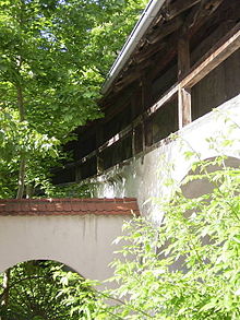
Old town Schongau
The old town in Schongau includes the historic city center of the Upper Bavarian city of Schongau . The old town is an ensemble based on the Monument Protection Act of October 1, 1973, the file number is E-1-90-148-1.
description
Schongau is a planned Staufer city built after 1225 . In 1268 it came into the possession of the Bavarian dukes. The abandonment of the nearby Altenstadt settlement was the reason for the establishment. The market was relocated to a strategically and traffic-wise more advantageous ridge above an old Lech crossing . Three main street axes and the side streets assigned at right angles formed the core city of the 13th century. The city was expanded in stages up to the 14th and 15th centuries. Century. The entire northern part of the city between Bauerngasse, northern Münzstrasse and northern Amtsgerichtsstrasse and the smaller southern part around Lindenplatz were consequently connected. Later the city lords also included the castle and the customs post northwest at the Maxtor. This can still be seen today from a bulge in the city plan at this point.
The Bavarian dukes had Schongau strongly fortified, especially the western side facing Swabia and Augsburg. The city's fortifications have largely been preserved. Surrounding walls, a number of towers and two of the five old gates still rise above the very edges of the plateau.
The Schongau street market extends from north to south over the longest stretch of the city. In its central part is the main axis of the Staufer core city. It forms the backbone of the city plan and was not used for through traffic, but as a parking space for trolleys and storage space for goods. The through traffic ran across the street market. The city was of great importance as a trading center for the Lech raftsmen and the Rott carts, as well as for Italian traffic. This is particularly evident in the late Gothic Ballenhaus . The Ballenhaus rises free-standing in the Marktstrasse axis and is a stately storage and council building.
To the east and west of this main street run Karmeliter- und Amtsgerichtsstraße to the east and Christophstraße / Bauerngasse to the west. Connecting and parallel alleys are usually arranged in a grid-like system to these three dominating axes. Some of them were probably overbuilt after the city fire of 1493. The development of the city is mostly closed, in which the gabled house of the adjacent Swabian area predominates. These are mostly two-storey plastered town houses and small houses, also town farmers' properties, from the 18th and early 19th centuries. The residential buildings show gradations in height and building dimensions from Marktstrasse in the direction of the side streets to the west and east of it. This gradation is also characteristic of the cityscape.
The town parish church, which is essentially late medieval, and the grounds of the former Carmelite monastery are the dominant baroque accents. Both enrich the largely medieval distant view of the city. In the interior of the city, the basic medieval character is determined by the Hohenstaufen floor plan. Despite major renovations to the building fabric, this basic character has largely been retained.
See also
literature
- Georg Paula , Stefanie Berg-Hobohm : District Weilheim-Schongau (= Bavarian State Office for Monument Preservation [Hrsg.]: Monuments in Bavaria . Volume I.23 ). Lipp, Munich 2003, ISBN 3-87490-585-3 , pp. 372 ff .
Web links
- Bavarian Monument Atlas (cartographic representation of the Bavarian architectural and ground monuments by the Bavarian State Office for Monument Preservation (BLfD) )
Coordinates: 47 ° 48 ′ 44.6 " N , 10 ° 53 ′ 49" E

