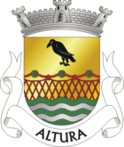
Altura (Castro Marim)
| Altura | ||||||
|---|---|---|---|---|---|---|
|
||||||
| Basic data | ||||||
| Region : | Algarve | |||||
| Sub-region : | Algarve | |||||
| District : | Faro | |||||
| Concelho : | Castro Marim | |||||
| Coordinates : | 37 ° 11 ′ N , 7 ° 30 ′ W | |||||
| Residents: | 2195 (as of June 30, 2011) | |||||
| Surface: | 11.1 km² (as of January 1, 2010) | |||||
| Population density : | 198 inhabitants per km² | |||||
| Postal code : | 8950-404 | |||||
| politics | ||||||
| Mayor : | Nélia Maria Corvo dos Santos Mateus ( PS ) | |||||
| Address of the municipal administration: | Junta de Freguesia de Altura Largo do Mercado Municipal 8950-404 Altura |
|||||
| Website: | www.jf-altura.pt | |||||
Altura is a municipality ( freguesia ) in the Portuguese district ( concelho ) of Castro Marim , in the Algarve . It has 2,195 inhabitants (as of June 30, 2011).
history
According to the history of the entire district, Altura was also a prehistoric settlement area before it became part of the Roman province of Lusitania . After the invasion of Germanic tribes in the 5th century AD, the Moors conquered the area in the early 8th century. In the course of the Reconquista , Paio Peres Correia conquered the area in 1242 , to King D.Afonso III. first gave town rights in 1277 .
The current municipality of Altura was only created in 1993 when the municipality split off from Castro Marim.
administration
Altura is the seat of a municipality of the same name ( Freguesia ), the smallest and youngest in the Castro Marim district. The municipality consists of the following two localities:
- Altura
- Praia da Alagoa
economy
The community is dominated by agriculture. In particular, viticulture and grain cultivation, and especially wheat, oats and barley, are the most important agricultural products, but citrus fruits and olive oil should also be mentioned. There is the dryland ago.
However, tourism, especially on Praia da Alagoa , has grown in importance in recent decades.
Web links
- Official website of the local government
- Profile Alturas in the Mapas de Portugal
Individual evidence
- ↑ a b www.ine.pt - indicator resident population by place of residence and sex; Decennial in the database of the Instituto Nacional de Estatística
- ↑ Overview of code assignments from Freguesias on epp.eurostat.ec.europa.eu
- ↑ History page of the parish website ( memento of the original from November 1, 2014 in the Internet Archive ) Info: The archive link was inserted automatically and has not yet been checked. Please check the original and archive link according to the instructions and then remove this notice. (port.), Retrieved March 2, 2013


