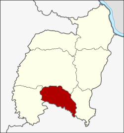
Amphoe Lue Amnat
|
Lue Amnat ลือ อำนาจ |
|
|---|---|
| Province: | Amnat Charoen |
| Surface: | 191.8 km² |
| Residents: | 36,920 (2013) |
| Population density : | 192.3 U / km² |
| ZIP : | 37000, 37120 |
| Geocode : | 3707 |
| map | |

|
|
Amphoe Lue Amnat ( Thai : อำเภอ ลือ อำนาจ ) is a district ( Amphoe - administrative district) in the south of the province of Amnat Charoen . The province of Amnat Charoen is located in the eastern part of the northeast region of Thailand , the so-called Isan .
geography
Neighboring Amphoe are counted from the west: the Amphoe Hua Taphan , Mueang Amnat Charoen and Phana of the province of Amnat Charoen, and Amphoe Muang Sam Sip in the province of Ubon Ratchathani .
history
Lue Amnat was initially set up as a subdistrict ( King Amphoe ) on April 1, 1991 , by separating six tambon from today's Amphoe Mueang Amnat Charoen . On December 5, 1996, Lue Amnat was promoted to Amphoe.
In 1993 Lue Amnat was one of the districts that made up the new province of Amnat Charoen.
administration
Provincial Administration
Amphoe Lue Amnat is divided into seven tambon ("subdistricts" or "municipalities"), which are further subdivided into 79 muban ("villages").
| No. | Surname | Thai | Muban | Pop. |
|---|---|---|---|---|
| 1. | Amnat | อำนาจ | 11 | 5,208 |
| 2. | Dong Mayang | ดง มะ ยาง | 7th | 4,105 |
| 3. | Pueai | เปื อย | 13 | 7,063 |
| 4th | Dong bang | ดง บัง | 16 | 6,381 |
| 5. | Rai Khi | ไร่ ขี | 10 | 4,501 |
| 6th | Maet | แม ด | 11 | 4,582 |
| 7th | Khok sound | โคก กลาง | 11 | 5,080 |
Local administration
There are five municipalities with "small town" status ( Thesaban Tambon ) in the district:
- Sam Nong (Thai: เทศบาล ตำบล สาม หนอง ) consisting of parts of the Tambon Amnat.
- Dong Mayang (Thai: เทศบาล ตำบล ดง มะ ยาง ) consisting of the complete tambon Dong Mayang.
- Pueai (Thai: เทศบาล ตำบล เปื อย ) consisting of the complete Tambon Pueai.
- Khok Klang (Thai: เทศบาล ตำบล โคก กลาง ) consisting of the complete Tambon Khok Klang.
- Amnat (Thai: เทศบาล ตำบล อำนาจ ) consisting of parts of the Tambon Amnat.
There are three municipalities with "Local Government Organization" ( Tambon Management Organizations ) status in the county:
- Dong Bang (Thai: องค์การ บริหาร ส่วน ตำบล ดง บัง ) consisting of the complete tambon Dong Bang.
- Rai Khi (Thai: องค์การ บริหาร ส่วน ตำบล ไร่ ขี ) consisting of the complete Tambon Rai Khi.
- Maet (Thai: องค์การ บริหารส่วน ตำบล แม ด ) consisting of the complete Tambon Maet.
Individual evidence
- ↑ ประกาศ กระทรวง มหาดไทย เรื่อง แบ่ง เขต ท้องที่ อำเภอ อำนาจเจริญ จังหวัด อุบลราชธานี ตั้ง เป็น กิ่ง อำเภอ ลือ อำนาจ . In: Royal Gazette . 108, No. 15 ง , January 31, 1991, p. 1070.
- ↑ พระราชกฤษฎีกา ตั้ง อำเภอ เหนือ คลอง อำเภอ นา ยาย อาม อำเภอ ท่า ตะเกียบ อำเภอ ขุน ตาล อำเภอ แม่ ฟ้า หลวง อำเภอ แม่ ลาว อำเภอ รั ษ ฎา อำเภอ อำเภอ พุทธ มณฑล อำเภอ วัง วัง น้ำ เขียว อำเภอ เจาะ ไอ ร้อง อำเภอ ชำนิ อำเภอ โนน ดินแดง อำเภอ ปาง สนธิ อำเภอ อำเภอ อำเภอ อำเภอ อำเภอ อำเภอ อำเภอ หนอง ม่วง อำเภอ เบญจ ลัก ษ์ อำเภอ โพน นา แก้ว อำเภอ บุ่ง คล้า อำเภอ ดอน มดแดง และ อำเภอ ลือ อำนาจ พ.ศ. ๒๕๓๙ . In: Royal Gazette . 113, No. 62 ก , November 20, 1996, pp. 5-8.
- ↑ 2013 population statistics . Department of Provincial Administration. Retrieved July 25, 2014.
Web links
Coordinates: 15 ° 42 ′ N , 104 ° 39 ′ E