Amur-Yakut Mainline
| Amur-Yakut Mainline | |||||||||||||||||||||||||||||||||||||||||||||||||||||||||||||||||||||||||||||||||||||||||||||||||||||||||||||||||||||||||||||||||||||||||||||||||||||||||||||||||||||||||||||||||||||||||||||||||||||||||||||||||||||||||||||||||||||||||||||||||||||||||||||||||||||||||||||||||||||||||||||
|---|---|---|---|---|---|---|---|---|---|---|---|---|---|---|---|---|---|---|---|---|---|---|---|---|---|---|---|---|---|---|---|---|---|---|---|---|---|---|---|---|---|---|---|---|---|---|---|---|---|---|---|---|---|---|---|---|---|---|---|---|---|---|---|---|---|---|---|---|---|---|---|---|---|---|---|---|---|---|---|---|---|---|---|---|---|---|---|---|---|---|---|---|---|---|---|---|---|---|---|---|---|---|---|---|---|---|---|---|---|---|---|---|---|---|---|---|---|---|---|---|---|---|---|---|---|---|---|---|---|---|---|---|---|---|---|---|---|---|---|---|---|---|---|---|---|---|---|---|---|---|---|---|---|---|---|---|---|---|---|---|---|---|---|---|---|---|---|---|---|---|---|---|---|---|---|---|---|---|---|---|---|---|---|---|---|---|---|---|---|---|---|---|---|---|---|---|---|---|---|---|---|---|---|---|---|---|---|---|---|---|---|---|---|---|---|---|---|---|---|---|---|---|---|---|---|---|---|---|---|---|---|---|---|---|---|---|---|---|---|---|---|---|---|---|---|---|---|---|---|---|---|---|---|---|---|---|---|---|---|---|---|---|---|---|---|---|---|---|---|---|---|---|---|---|---|---|---|---|---|---|---|---|---|---|---|
|
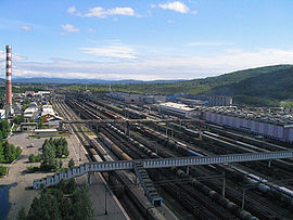
Tynda train station
| |||||||||||||||||||||||||||||||||||||||||||||||||||||||||||||||||||||||||||||||||||||||||||||||||||||||||||||||||||||||||||||||||||||||||||||||||||||||||||||||||||||||||||||||||||||||||||||||||||||||||||||||||||||||||||||||||||||||||||||||||||||||||||||||||||||||||||||||||||||||||||||
| Route length: | 1208 km | ||||||||||||||||||||||||||||||||||||||||||||||||||||||||||||||||||||||||||||||||||||||||||||||||||||||||||||||||||||||||||||||||||||||||||||||||||||||||||||||||||||||||||||||||||||||||||||||||||||||||||||||||||||||||||||||||||||||||||||||||||||||||||||||||||||||||||||||||||||||||||||
| Gauge : | 1520 mm ( Russian gauge ) | ||||||||||||||||||||||||||||||||||||||||||||||||||||||||||||||||||||||||||||||||||||||||||||||||||||||||||||||||||||||||||||||||||||||||||||||||||||||||||||||||||||||||||||||||||||||||||||||||||||||||||||||||||||||||||||||||||||||||||||||||||||||||||||||||||||||||||||||||||||||||||||
|
|||||||||||||||||||||||||||||||||||||||||||||||||||||||||||||||||||||||||||||||||||||||||||||||||||||||||||||||||||||||||||||||||||||||||||||||||||||||||||||||||||||||||||||||||||||||||||||||||||||||||||||||||||||||||||||||||||||||||||||||||||||||||||||||||||||||||||||||||||||||||||||
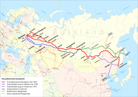
The Amur-Yakut Main Line ( Russian: Амуро-Якутская магистраль ; abbrev. AJAM, АЯМ) is a railway line in Siberia , Russia , which connects the Trans-Siberian Railway (Transsib) and the Baikal-Amur Main Line (BAM) to the south of the Republic of Sakha (Yakutia) connects.
designation
The name “Amur-Yakut Magistrale” is an unofficial name, but it is also used by official representatives of the Russian railways; there is no state or private railway administration with this name, just as there was never a Trans-Siberian Railway in this sense and since July 1996 there has been no Baikal-Amur Mainline . The southern part of the line to Neryungri is operated by the Far East Railway , the Berkakit / Neryungri - Tommot section by the Yakutian Railway Company (Russian: ОАО АК Железные дороги Якутии, OAO AK Schelesnyje dorogi Jakutii).
Routing
At the moment the route is 1215 km long. At the Bamovskaya station in the west of the Amur Oblast, it branches off from the Trans-Siberia in a northbound direction (route km 7273 from Moscow ). On the 179 kilometers to Tynda is Tukuringragebirge crossed. After a 27 km long section with the BAM to Bestuschewo, the route turns north again. In this area, the Giljui River is crossed twice. Shortly after reaching the territory of the Sakha Republic, the pass height of the Stanowoy Mountains is approx. 1040 m above sea level. NN with the 1300 m long Nagorny tunnel crossed. The route continues through the Aldan highlands , with the maximum height of approx. 1200 m above sea level. NN is reached. Several larger rivers, such as the Ijengra and the Tschulman , are crossed - sometimes several times. The coal mining area around Berkakit and Nerjungri is reached around kilometer 400, the regional center Aldan at kilometer 686 and Tommot at kilometer 767. Tommot train station is on the western bank of the Aldan river , which is crossed by the longest bridge on the route. In 2006, the provisional freight traffic to Verkhnyaya Amga ( Amga station, kilometer 869) was started, where the river of the same name is crossed.
| station | Distance kilometers |
comment |
|---|---|---|
| Bamovskaya | 0 | at the settlement of Bam, junction from the Transsib (km 7273) |
| Tynda | 179 | second largest city in the route, so-called "capital of the BAM", intersection with the BAM (km 2349 from Taischet ) |
| Nerjungri | 408 | largest city in the route, center of coal mining and power generation (coal power plants), but the depletion of the deposits is foreseeable |
| Tschulman | 430 | another town in the mining area around Neryungri; power plant |
| Aldan | 686 | Mining center (gold, iron ore) in the Aldan highlands |
| Tommot | 767 | Small town, mica deposit, timber industry |
| Amga ( Verkhnyaya Amga ) | 869 | Settlement, agriculture, small airfield |
| Karbykan | 932 | tracks were laid up to here in 2006, |
The line is not electrified and mostly single-track. Only the common section with the BAM Tynda-Bestuschewo is double-tracked.
During construction and operation there were and are the difficulties common to railways in most parts of Siberia in connection with permafrost soils and large temperature gradients between winter (below –50 ° C) and summer (above +30 ° C), here in connection with sometimes complicated ones topographical conditions especially in the area of the Aldan highlands.
history
The history of the railway begins in the 1930s, when the Bamovskaya – Tynda (then Tyndinski) branch line was built as part of the planned construction of the Baikal-Amur Mainline. This section was put into operation in 1935, but dismantled again in 1941/42 when the construction of the BAM was temporarily suspended due to the war and the rails were needed for the construction of new lines close to the front (" Volga Rochade ").
Even before the Soviet leadership officially proclaimed the reopening of the BAM building at the beginning of 1974 (“building of the century”), work on the reconstruction of the Bamovskaya – Tynda section began on April 5, 1972. The start of provisional operation on this line, now known as the "Little BAM", took place in November 1976, regular operation began in October 1977. At the same time, the line continued northwards, operations to Berkakit in October 1979, and later to Neryungri.
From 1989 the construction of the continuation of the line from Neryungri took place first in the direction of Tschulman. Since then, the name “Amur-Yakut Magistrale” has been used for the route based on the “Baikal-Amur Magistrale” as well as the road connection Newer-Yakutsk, the “Amur-Yakut Automobile Highway” (unofficially; officially Federal Automobile Highway M56 “Lena” ) and extended to the "main line" Bamovskaya – Tynda – Nerjungri, the former “Little BAM”. The starting point for the continuation is a junction a few kilometers before the previous end point Neryungri Grusowaja (freight yard). The traffic to Tschulman, Aldan and finally to Tommot was gradually taken up (first construction and freight traffic, then passenger traffic). The handover to the provisional operation of the entire route to Tommot took place on August 24, 2004. Since then (according to other information already since 2003) a daily pair of passenger trains Nerjungri – Tommot has been running. This 368-kilometer section took a good 8 hours. On May 22, 2006, regular passenger traffic on the route to Aldan was released.
The bridge over the Aldan River in Tommot, which is the largest in the catchment area of the route alongside the Lena and here about 400 m wide, was built in the 1990s, but not put into operation for the time being. An approx. 60 km long section beyond that was under construction before further construction, mainly due to the unclear distribution of the financing between the Russian railway, which is run as an AG - albeit state - run, the state federal budget of Russia (the "investment fund"), own resources of Sakha Republic and possible private investors was interrupted.
From 2005 the further construction was resumed. The tracks were laid to Karbykan at the beginning of 2007 (construction train traffic); the then still provisional freight traffic ended in Amga. By August 2009 the tracks had been laid up to kilometer 575 (calculation from Berkakit, about 974 km of the total length) at Uluu. In July 2011, the laying of the track had progressed up to about 50 km from Nizhny Bestjach. On November 15, 2011, the first tracks were laid in Nizhny Bestjach in the presence of President Dmitry Medvedev . On July 27, 2019, the first passenger train coming from Tommot reached Nizhny Bestjach.
Perspectives
In 2006 the construction of a combined railway and car bridge over the Lena near Yakutsk or about 70 km upstream, where the valley is narrower, was discussed. This decision should have been made in 2017. The commissioning of the railway line from Tommot to Nizhny Bestjach was planned for the end of 2017, but the passenger traffic did not take place until July 27, 2019. For the future there are ideas to continue the route east to the Kolyma area and on to Chukotka with branches e.g. B. to Magadan , but from today's perspective they seem utopian.
literature
- Transport Strany Sowetow (German Transport of the Soviet Country), Moscow Transport 1987. (Russian)
- Yevgeny Koslowski. BAM: Kak wsjo natschinalos [ Ger . BAM: How it all began]. Promyshlennyye vedomosti magazine , July 2002. (Russian)
- Soviet topographic maps 1: 200,000 (sheets N-51-V, N-51-XI, N-51-XII, N-51-XVI, N-51-XVII, O-52-VII, O-51-XII, O-51-XVIII, O-51-XXIII, O-51-XXIX, O-51-XXXV)
- Order No. 54 of May 2, 2006 of the Federal Agency for Rail Transport (ROSSCHELDOR) (Федеральное Агентство железнодорожного транспорта (РОСЖЕЛДОР))
Web links
General information
- Timetables and route kilometers on a Russian railway website (Russian and English)
- Route kilometers Transsib and BAM on the Transsib website (Russian, partly English)
- Federal Motorway M56 (based on travel reports, Russian)
- Route plan and profile (Russian) ( Memento from September 27, 2007 in the Internet Archive )
Development over the last few years and perspective
- The train to the north (in Gudok , December 24, 2003, in Russian)
- Thirty Years of "Celibacy" (in Dalnewostochny Capital , July 2004, Russian) ( Memento from April 23, 2007 in the Internet Archive )
- Bridge until 2011? (in Gudok , September 15, 2006, Russian)
- Article on GIPROTRANSTEI's proposals for railway construction by 2020 (in Gudok , April 12, 2006, in Russian)
- Article on railway construction in Nasche Vremja from August 28, 2009, in Russian
- Yakut Railway: "Opening of Passenger Traffic " on the Tommot - Nizhny Bestjach line, July 23, 2019 (Russian)

