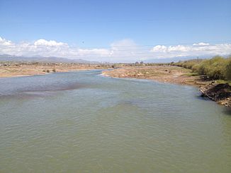
Angren (river)
|
Angren Оҳангарон (Ohangaron), Ангрен, Ахангаран (Achangaran) |
||
| Data | ||
| location | Namangan , Tashkent ( Uzbekistan ) | |
| River system | Syr Darya | |
| Drain over | Syr Darya → Aral Sea | |
| Confluence of |
Aktashsaja and Urtalyksaja on the SE flank of the Chatkal Mountains 41 ° 17 ′ 55 ″ N , 70 ° 37 ′ 13 ″ E |
|
| muzzle |
Syrdarya coordinates: 40 ° 47 '32 " N , 68 ° 50' 29" E 40 ° 47 '32 " N , 68 ° 50' 29" E
|
|
| length | 223 km | |
| Catchment area | 5260 km² | |
| Drain at the Turk gauge |
MQ |
23 m³ / s |
| Right tributaries | Karasu | |
| Reservoirs flowed through | Achangaran Reservoir , Tjuijabugus Reservoir | |
| Big cities | Angren | |
| Medium-sized cities | Ohangaron | |
|
Course of the Angren (Ахангаран) |
||
The Angren ( Uzbek Angren; Tajik Оҳангарон (Ohangaron); Russian Ангрен, Ахангаран (Achangaran)) is a right tributary of the Syrdarja in Uzbekistan .
The Angren arises at the confluence of the Aktaschsaja and Urtalyksaja rivers in the Namangan Province on the southeast flank of the Chatkal Mountains in western Tianshan . It flows in the upper reaches in a south-westerly direction into the province of Tashkent . It flows through a ravine which cuts through the Angren plateau . The valley widens later. Here the river to the Achangaran reservoir is dammed. Downstream are the towns of Angren and Ohangaron . In the lower reaches of the Angren flows through the Tjuijabugus reservoir , absorbs the Karasu and finally flows into the Syrdarja on the right after 223 km. The Angren drains an area of 5260 km². The Angren reaches its greatest drainage during the snowmelt in May.

