Anguienne
| Anguienne | ||
|
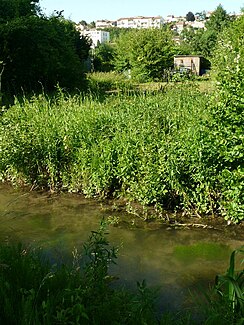
The Anguienne at Fontgrave in Angoulême |
||
| Data | ||
| Water code | FR : R2340500 | |
| location | France , Nouvelle-Aquitaine region | |
| River system | Charente | |
| Drain over | Charente → Atlantic Ocean | |
| source | in the municipality of Dirac 45 ° 36 ′ 25 ″ N , 0 ° 15 ′ 50 ″ E |
|
| Source height | approx. 117 m | |
| muzzle | at Angoulême in the Charente coordinates: 45 ° 39 ′ 20 ″ N , 0 ° 8 ′ 29 ″ E 45 ° 39 ′ 20 ″ N , 0 ° 8 ′ 29 ″ E |
|
| Mouth height | approx. 32 m | |
| Height difference | approx. 85 m | |
| Bottom slope | approx. 6.5 ‰ | |
| length | 13 km | |
|
The Anguienne near Lion de Saint-Marc (municipality of Soyaux) |
||
The Anguienne is a river in southwestern France that runs in the Nouvelle-Aquitaine region . The river has its source in the municipality of Dirac . After 13 kilometers, it flows into the Charente as a left tributary at Île aux Vaches in Angoulême . The average gradient is 6.34 m / km.
etymology
The Anguienne is called Fluvium Inguine in the 11th century and is first mentioned in 1150 as Enguena . Around 1300 it is recorded as Ripperia de Enguena or Riparia Enguene . According to Billy, the word consists of the root eco or ico and the suffix enna . The root is of Gallic origin and means water, source . Icauna was a Gallic water goddess. By shifting the sound, the root later changed to equ and finally to narrow , ing . The same development can also be observed in the city name of Angoulême, which goes back to the same root. Angoulême was called Icolisma under the Romans .
Crossed departments
- Charente , in the Nouvelle-Aquitaine region
Places on the river
- In the canton of Boëme-Échelle :
- In the canton of Angoulême-3 :
Hydrography
With a total length of 13.4 kilometers, the difference in altitude is 85 meters. The Anguienne has no tributaries worth mentioning, but small arid valleys flow into it from both sides - for example the Combe du Bressour and L'Escargot on the right .
geography
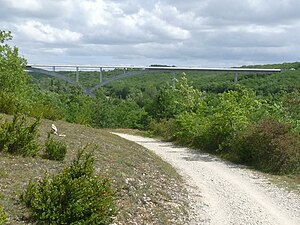
The Anguienne rises at 117 meters above sea level near Le Boisseau in the municipality of Dirac. Its direction of flow is initially west-northwest (N 300), but turns in the second section to northwest (N 311). It passes at the foot of the Château de la Tranchade , flows past the Moulin du Got , runs below the Logis d'Hurtebise and crosses the Lion de Saint-Marc district in the municipality of Soyaux. Since 2005, the river valley on the Bois du Bressour has been spanned by the impressive Anguienne Bridge of the Angoulême bypass (D 1000).
In the area of the city of Angoulême, the river is canalized. It can still be seen at Petit Fresquet and Fontgrave , but then disappears in the district of Le Pont de Vars . It only reappears at the Moulin des Dames and finally flows into the Charente at the Île aux Vaches .
The valley floor of the Anguienne is covered by numerous dammed ponds , larger ones are located on the upper reaches at Le Moulin de Baloge , Le Maine Terrou and below the source at Le Boisseau .
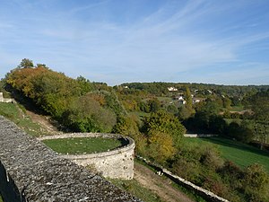
The river valley separates the plateau on which Angoulême is built from the plateau around the district of Ma Campagne in the south.
geology
The source of the Anguienne is located in the flat layers of the Oberturon , which belong to the northern Aquitaine Basin . The river then cuts successively through stratigraphically deeper layers of the Upper Cretaceous to the mouth . Below the Logis d'Hurtebise it meets Unterturon and from the district of Saint-Martin on Cenomanium (Upper and Middle Cenomaniac), which it follows to the mouth. The 10-meter-thick limestone bar of the Angoumiens above the contact between Unter- and Oberturon was once quarried in numerous quarries as a building block (especially for the city of Angoulême) on both sides of the Anguienne.
The valley floor of the Anguienne is filled with Holocene alluvium , which has a peat horizon at its base that was previously mined. Its age is estimated to be Boreal or Atlantic , that is, 8000 to 6000 BC. Chr.
Protective measures
The Anguienne valley forms a ZNIEFF ( Zone Naturelle d'Intérêt Écologique Faunistique et Floristique ) and is therefore under nature protection. Like the neighboring valley of the Eaux Claires , it falls under Natura 2000 .
Landmarks on the river
- Anguienne bridge
- Château de la Tranchade from the 14th century
- Logis d'Hurtebise
Long-distance hiking trails
The Anguienne valley is crossed by several long-distance hiking trails on the upper reaches :
- from the GR 4 from Royan to Grasse
- from the GR 36 from the English Channel to the Pyrénées-Orientales and
- from the GR de Pays Entre Angoumois et Périgord , which connects the Angoumois with the Périgord .
See also
literature
- B. Bourgeuil and P. Moreau: Angoulême XVII-32 . In: Carte géologique de la France at 1/50 000 . BRGM.
Web links
Individual evidence
- ↑ a b geoportail.gouv.fr (1: 16,000)
- ↑ a b The information on the length of the river is based on the information on the Anguienne from SANDRE (French), accessed on December 23, 2010, rounded to full kilometers.
- ^ Pierre-Henri Billy: Dictionnaire des noms de lieux de la France . DNLF, éditions Errance, 2011, ISBN 978-2-87772-449-4 , pp. 639 .


