Ano Doliana
|
Ano Doliana Άνω Δολιανά |
||
|---|---|---|
|
|
||
| Basic data | ||
| Country |
|
|
| region | Peloponnese | |
| Regional district | Arcadia | |
| local community | Voria Kynouria | |
| Local community | Doliana | |
| Geographic coordinates | 37 ° 23 ' N , 22 ° 30' E | |
| Height above d. M. |
1000 m |
|
| Residents | 90 (2011) | |
| LAU-1 code no. | 4002000701 | |
| Post Code | 220 13 | |
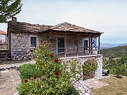
| Ano Doliana Ethnographic Museum | ||
Ano Doliana ( Greek Άνω Δολιανά [ ˈano ðolianˈa ] ( n. Pl. )) Is a mountain village with stone houses in the municipality of Voria Kynouria in eastern Arcadia in Greece . In 2011 it had 90 inhabitants. It is a protected traditional settlement.
Today only a handful of settlers live in the village all year round, most of them only use it as a summer residence due to the milder climate and spend the winter in Kato Doliana instead .
geography
The village lies on the southern edge of the plain of Tripoli . It is located at an altitude of 950 to 1,050 meters on the northern slope of Mount Parnon . Surrounded by firs , chestnuts , plane trees , bird and sour cherries as well as small rivers and waterfalls, one overlooks the high plateau from Tripoli to the mountains of Mainalo , Artemisio , Chelmos and Erymanthos .
Demographic development
| year | population |
|---|---|
| 1940 | 1,594 |
| 1951 | 66 |
| 1961 | 12 |
| 1971 | 6th |
| 1981 | 19th |
| 1991 | 69 |
| 2001 | 80 |
| 2011 | 90 |
history
In ancient times, the marble deposits were mined immediately northwest of the village. It is one of the best marbles of the Peloponnese and shows similarities with the Pentelic marble of Attica, but does not achieve its high quality properties. The marble quarries of Doliana provided material for the construction of the temple of Athena Alea in Tegea, the Temple of Apollo near Bassae and for sculptures in Olympia . The sculptor Damophon von Messene made the large group of figures of Demeter and Despoina in the sanctuary of Lykosoura from Doliana marble. The old quarry is still in operation today.
Modern times
On May 18, 1821, the Battle of Doliana was fought near the place. Nikitaras , who was in Ano Doliana with 200 men, managed to repel 4,000 Ottoman soldiers who were also raised with artillery. Tradition says that Nikitaras was nicknamed Tourkofagos (Τουρκοφάγος - Turkish eater) because of this battle .
activities
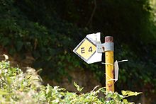
The European long-distance hiking trail E4 leads directly through Doliana.
The village at the northernmost point of Mount Parnon also serves as the starting point for the Parnon Trail, a 200-kilometer trekking trail that picks up on old trails in the region and is intended to be revived by local volunteer groups. It crosses the Parnon Mountains in the entire region of Kynouria and connects mountain and sea on its way.
Individual evidence
- ↑ Results of the 2011 census at the National Statistical Service of Greece (ΕΛ.ΣΤΑΤ) (Excel document; 2.6 MB).
- ↑ FEK Δ 1081/2003 «Χαρακτηρισμός οικισμών του Νομού Αώνρκαδίας ως παραδοσιακών και κατθορισμός ειδηινιντιντηντω ρνηω ρινιντω ρνη ρνη πντω ερνη ρνιν πντω P. 10749 (PDF; 2.3 MB; Greek).
- ↑ Athanasios Themos: Temple of Athena Alea. Ministry of Culture and Sport (English).
- ^ Richard Lepsius : Greek marble studies. Royal Academy of Sciences, Berlin 1890, pp. 31–34, 112.
- ↑ Waymarked Trails: Hiking Trails. E4.
- ↑ Hiking in Ano Doliana. In: 5ente.com. (English).
- ↑ The dream comes true! In: ParnonTrail.eu. (English).
Web links
- KentrikosDoliana.gr. Site of the Central Patriotic Association of Doliana Kynouria (Greek).


