Terumbu Ubi
| Terumbu Ubi (Ardasier Reef) |
||
|---|---|---|
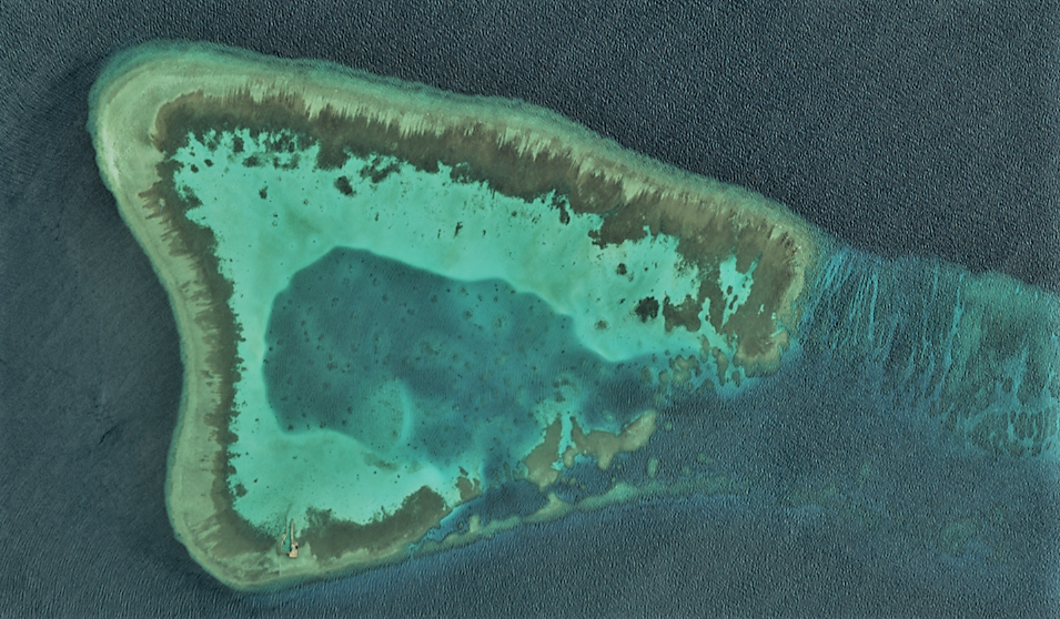
| Landsat picture (southwestern part) | ||
| Waters | South China Sea | |
| Geographical location | 7 ° 45 ' N , 114 ° 14' E | |
|
|
||
| Number of islands | 0 | |
| length | 4.7 km | |
| width | 3.3 km | |
| Land area | ||
| total area | 10 km² | |
| Highest elevation | 0 m | |
| Residents | 20th | |
The Ardasier Reef or ( Malay ) Terumbu Ubi is a reef of the Spratly Islands that is only visible at low tide.
geography
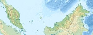
Located 290 kilometers off the northwest coast of Sabah State, the reef is claimed by Malaysia and administratively considered part of the city of Kota Kinabalu , the capital of Saba.
The reef has an extension of 4.7 by 3.3 kilometers, with a total area of around ten square kilometers. It is part of the much larger Ardasier Bank (Permatang Ubi) . It is located at the southwest end of the Ardasier Bank and is its only, occasionally dry-falling reef, and itself encloses a comparatively small lagoon with an area of around five square kilometers.
The island in the Spratly conflict
Within the conflict over the Spratly Islands , the Ardasier Reef is also claimed by several nations. Most recently, on March 5, 2009, the Malaysian Prime Minister Abdullah Ahmad Badawi landed on the Swallow Reef and Ardasier Reef of China's Nansha Islands to claim the islands as Malaysian territory.
The Malaysian military has quite extensive facilities on the Ardasier Reef, including a helipad , a field for the Sepak Takraw game, gun emplacements and a control tower. The facilities are almost identical to those on Erica Reef, Mariveles Reef and Investigator Shoal.
Malaysia refers to the continental shelf argument (Shelf of Sabah and Sarawak) or the 200-mile zone in its legal claims. It claims a total of 12 southern Spratly Islands and currently has six islands or reefs occupied (Ardasier Reef, Dallas Reef, Erica Reef, Investigator Shoal, Mariveles Reef and Swallow Reef). The legal claims are well secured by the Convention on the Law of the Sea . Malaysia has a modernly equipped navy (10 missile frigates ).
Individual evidence
- ↑ Dokumen Gazetir: Sabah ( Memento of the original from March 3, 2016 in the Internet Archive ) Info: The archive link was inserted automatically and has not yet been checked. Please check the original and archive link according to the instructions and then remove this notice. , P. 59.
- ↑ measured with ArcGis Here Satellite Image Tiles
- ↑ China sends more patrol ships to South China Sea , China Internet Information Center (CIIC), online edition, March 20, 2009; Accessed January 16, 2012.
- ↑ a b Malaysia’s Sovereignty Claim Based on Continental Reef Principle ; Accessed January 16, 2012.
- ^ The race of the Southeast Asian states for the Spratly Islands ; Accessed January 16, 2012.
Web links
- Sailing Directions (Enroute) - Borneo, Jawa, Sulawesi and Nusa Tenggara (PDF; 805 kB), United States Navy Publication 163, Chapter 11, 2002; Accessed January 16, 2012
- List of the names of all Spratly features known to be occupied and / or above water at low tide ; Accessed January 16, 2012
- Satellite map
Remarks
- ↑ The English name for Permatang Ubi is Ardasier Reef . In the marine literature there is also the name Ardasier Bank (Permatang Ubi) for the associated shoal.

