Atabae (place)
| Atabae | ||
|---|---|---|
|
|
||
| Coordinates | 8 ° 49 ′ S , 125 ° 9 ′ E | |

|
||
| Basic data | ||
| Country | East Timor | |
| Bobonaro | ||
| Administrative office | Atabae | |
| ISO 3166-2 | TL-BO | |
| Suco | Rairobo | |
| height | 489 m | |
|
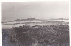
The place of Atabae (1970)
|
||
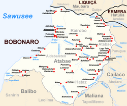
Atabae is a place in Suco Rairobo ( Atabae administrative office , Bobonaro municipality ). The place is also called Rairobo after the Suco.
In 1936 Atabae was renamed Atalaia by the Portuguese . But the name did not catch on and a few years after the Second World War , the old name was reverted to.
The place is at an altitude of 489 m . It is about 55 kilometers (85 kilometers by road) to the northeast to the state capital Dili as the crow flies, and about 17 kilometers to the south to the municipal capital Maliana . A country road connects Atabae with Aidabaleten , the main town of the administrative office, which is about 5 kilometers away on the Sawusee .
The village has a primary school, the Escola Primaria Rairobo , and a medical station. A reforestation project is being carried out near the site. The Monte Atabae ( Goenoeng Atabai ) is 4.1 kilometers away from Atabae.
Individual evidence
- ↑ a b Fallingrain.com
- ↑ Geoffrey Hull : The placenames of East Timor , in: Placenames Australia (ANPS): Newsletter of the Australian National Placenames Survey, June 2006, pp. 6 & 7, ( Memento of February 14, 2017 in the Internet Archive ). September 2014.
- ^ João Soares: Novo Atlas Escolar Português , 5th updated edition, Lisboa 1954
- ↑ List of polling stations for the parliamentary elections in East Timor 2007 (PDF file; 118 kB)
- ↑ UNMIT: Timor-Leste District Atlas version 02, August 2008 ( Memento of November 8, 2012 in the Internet Archive ) (PDF file; 522 kB)

