
Aubach (Pilsensee)
| Aubach | ||
 Catchment area of the Aubach. The most important moraine lines are toned. |
||
| Data | ||
| Water code | DE : 164318 | |
| location | Starnberg District , Upper Bavaria , Bavaria , Germany | |
| River system | Danube | |
| Drain over | Pilsensee → Fischbach (Ammersee) → Ammersee → Amper → Isar → Danube → Black Sea | |
| origin | near Weßling-Neuhochstadt 48 ° 3 ′ 57 ″ N , 11 ° 15 ′ 30 ″ E |
|
| Source height | 577 m above sea level NHN | |
| muzzle | in the Pilsensee coordinates: 48 ° 2 ′ 6 ″ N , 11 ° 11 ′ 48 ″ E 48 ° 2 ′ 6 ″ N , 11 ° 11 ′ 48 ″ E |
|
| Mouth height | 534.4 m above sea level NHN | |
| Height difference | 42.6 m | |
| Bottom slope | 6.1 ‰ | |
| length | 7 km | |
| Communities | Weßling , Seefeld (Upper Bavaria) | |
 Aubach near Seefeld |
||
The Aubach is an approximately 7 km long tributary of the Pilsensee in Upper Bavaria .
course
The Obere Aubach arises in Plonnermoos in the south of the municipality Weßling near the Neuhochstadt district in a wetland. After the union of the Hochstadter Bach and the Moosgraben, the now called Aubach flows in a south-westerly direction through the wide Aubach valley past Oberalting (Seefeld municipality) and flows into the northern end of the Pilsensee at Hechendorf .
Character and environment
The Aubach drains a depression that was left behind by a side tongue of the Isar-Loisach glacier at the end of the Würme Ice Age and is framed by end and side moraines . Apart from its upper course, the Aubach has the character of a meadow brook that has been largely straightened in the Aubach valley. A mill ditch is diverted at Oberalting. An important building and at the same time a striking landmark of the Aubach Valley is the Seefeld Castle .

Plonnermoos near Neuhochstadt

Dammed Upper Aubach near Hochstadt
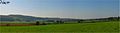
View from Delling to the southwest into the Aubach valley


literature
- RKF Meyer, H. Schmidt-Kaler: Walks in the history of the earth , Volume 9: On the trail of the Ice Age south of Munich - western part . Publishing house Dr. Friedrich Pfeil, Munich 1997, ISBN 3-931516-10-5