Auerbach (Westernach)
| Auerbach | ||
|
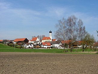
Valley near Oberauerbach, the stream runs by the birch row |
||
| Data | ||
| Water code | DE : 11622 | |
| location | District of Unterallgäu , District of Swabia , Bavaria , Germany | |
| River system | Danube | |
| Drain over | Westernach → Mindel → Danube → Black Sea | |
| source | Forest southwest of Wineden (municipality of Markt Rettenbach ) | |
| Source height | approx. 750 m above sea level NHN | |
| muzzle | near Unterauerbach (municipality of Mindelheim ) in the Westernach coordinates: 48 ° 2 '55 " N , 10 ° 27' 36" E 48 ° 2 '55 " N , 10 ° 27' 36" E |
|
| Mouth height | approx. 594 m above sea level NHN | |
| Height difference | approx. 156 m | |
| Bottom slope | approx. 9.4 ‰ | |
| length | 16.6 km | |
| Catchment area | 28.53 km² | |
| Small towns | Mindelheim | |
| Communities | Rettenbach Market , Stetten (Swabia) | |
The Auerbach is a 16 kilometer long stream in the Unterallgäu .
course
The source of the Auerbach is located in a forest a little southwest of Wineden . It flows consistently approximately northwards west of Wineden and Buchenbrunn , and east past Markt Rettenbach and Lannenberg , then west again past Eutenhausen and through Mussenhausen (all to the municipality of Markt Rettenbach) to Stetten , which it crosses. Then it runs through the Oberauerbach , which is mostly on the left, and flows into the Westernach from the left between this and the Unterauerbach district, which also belongs to Mindelheim .
The Auerbach spring was the drinking water supply of Wineden until 2012.
Individual evidence
- ↑ a b Length and catchment area according to: List of brook and river areas in Bavaria - Danube river area from source to Lech, page 33 of the Bavarian State Office for the Environment, as of 2016 (PDF; 2.3 MB) "(Number of pages may change.)
