
Avarua
| Avarua | |||
|---|---|---|---|
|
|||
| Coordinates | 21 ° 12 ′ S , 159 ° 47 ′ W | ||
_map.png)
|
|||
| Basic data | |||
| Country | Cook Islands | ||
| Main island | Rarotonga | ||
| ISO 3166-2 | CK | ||
| height | 10 m | ||
| Residents | 13,100 (2011) | ||
| Website | cook-islands.gov.ck | ||
 Main street in Avarua (2006)
|
|||

Avarua is the capital of the South Pacific located Cook Islands , which a sovereign state in voluntary association with New Zealand form. The main island of Rarotonga had 13,095 inhabitants in 2011.
geography
Avarua is located on the north coast of the volcanic main island of Rarotonga, which in turn belongs to the southern part of the archipelago. Coral reefs surround Rarotonga, it is bordered by a fertile coastal strip, inside dense jungle with countless fern and palm species. The city is their seat of government and administrative center and with a population of 5,445 ( 2006 census ) is also their largest settlement.
climate
| Avarua | ||||||||||||||||||||||||||||||||||||||||||||||||
|---|---|---|---|---|---|---|---|---|---|---|---|---|---|---|---|---|---|---|---|---|---|---|---|---|---|---|---|---|---|---|---|---|---|---|---|---|---|---|---|---|---|---|---|---|---|---|---|---|
| Climate diagram | ||||||||||||||||||||||||||||||||||||||||||||||||
| ||||||||||||||||||||||||||||||||||||||||||||||||
|
Average monthly temperatures and rainfall for Avarua
|
||||||||||||||||||||||||||||||||||||||||||||||||||||||||||||||||||||||||||||||||||||||||||||||||||||||||||||||||||||||||||||||||||||||||||||||||||||||||||||||||||||||||||||||||||||||||||||||||||||||||||||||||||
history
Originally inhabited by Māori , they were discovered for the Europeans by James Cook between 1773 and 1777, belonged to the British Empire for a long time and only became independent in 1965. The islanders opted for political affiliation with New Zealand, but kept their own administration. Christianity was widely spread through the work of the missionaries; but there are also many other religions.
economy
Avarua has a small port (Avatiu) and an international airport . Since this is designed for large passenger planes that regularly fly to Rarotonga, Avarua serves as a distribution hub for tourism on the Cook Islands. The inhabitants live mainly from tourism, trade , fishing and agriculture .
Trivia
A Martian crater is named after Avarua .
gallery

House on the Beach (before 1906)

CICC Church (2011)

Para O Tane Palace (1994)

Port (2006)
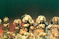
Folklore (2006)

Main street in Avarua (2003)


Web links
Individual evidence
- ↑ Census of Population and Dwellings 2011. Statistics Office, December 2012, p. 39.
- ↑ Originality preserved , badische-zeitung.de, accessed on June 9, 2016
- ↑ About Cook Islands ( Memento from September 28, 2016 in the Internet Archive ), cook-islands.gov.ck, accessed on June 9, 2016 (English)
- ↑ Originality preserved , badische-zeitung.de, accessed on June 9, 2016
- ↑ Between dream and reality , deutschlandfunk.de, from February 8, 2015