Ayabaca
| Ayabaca | ||
|---|---|---|
|
|
||
| Coordinates | 4 ° 38 ′ S , 79 ° 43 ′ W | |
| Symbols | ||
|
||
| Basic data | ||
| Country | Peru | |
| Piura | ||
| province | Ayabaca | |
| ISO 3166-2 | PE-PIU | |
| District | Ayabaca | |
| height | 2715 m | |
| Residents | 5985 (2017) | |
| founding | 1571 | |
|
View of Ayabaca
|
||
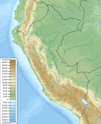
Ayabaca is the capital of the Ayabaca province and the district of the same name in the northeast of the Piura region in northwest Peru . The 2017 census counted 5985 inhabitants. 10 years earlier the population was 6,047.
Ayabaca was founded by the Spanish in 1571 after the number of indigenous people in the region had already been severely decimated. The full name is "Nuestra Señora del Pilar de Ayavaca" after Ayabaca's first patroness. The city is located in the western chain of the Andes at 2715 m. The current city patron is the "Señor Cautivo". Its great patronage festival is celebrated year after year around October 13th and is attended year after year by a large crowd of believers.
In 1802, Ayabaca was visited by Alexander von Humboldt , who was able to determine the height of the city at 2,715 meters.
Web links
Individual evidence
- ↑ a b PERU: Region Piura: Provinces & Places . www.citypopulation.de. Retrieved December 15, 2019.
- ^ Eduardo Orrego Acuña: Alexander von Humboldt and Peru. In: La Casa de Cartón, II Época No. 12, 1997.


