Bömericher Bach
| Bömericher Bach | ||
|
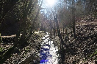
Upper course of the Bömericher Bach north of Bömerich |
||
| Data | ||
| Water code | DE : 27368332 | |
| location |
Bergische plateaus
|
|
| River system | Rhine | |
| Drain over | Dhünn → Wupper → Rhine → North Sea | |
| source | between Bömerich and Hüttchen 51 ° 3 ′ 30 ″ N , 7 ° 10 ′ 13 ″ E |
|
| Source height | 204.5 m above sea level NN | |
| muzzle | at Loosenau in the Dhünn coordinates: 51 ° 4 ′ 1 ″ N , 7 ° 10 ′ 38 ″ E 51 ° 4 ′ 1 ″ N , 7 ° 10 ′ 38 ″ E |
|
| Mouth height | 120.2 m above sea level NN | |
| Height difference | 84.3 m | |
| Bottom slope | 50 ‰ | |
| length | 1.7 km | |
| Catchment area | 1.37 km² | |
| Discharge A Eo : 1.37 km² at the mouth |
MNQ MQ Mq |
1.12 l / s 23.05 l / s 16.8 l / (s km²) |
The Bömericher Bach is an orographic left, 1.7 km long tributary of the Dhünn .
geography
course
The Bömericher Bach rises at a height of 204.5 m above sea level. NHN at Hüttchen and flows counterclockwise around Bömerich and then past the Bömericher Mühle . It finally joins the Dhünn from the left at 120.2 m at Loosenau .
Tributaries
Tributaries of the Bömericher Bach are:
- Bömericher Delle (right), 0.5 km
- Eichholzbach (right), 0.6 km
- Knechsiefen (right), 0.6 km
- Bömericher Siefen (left), 0.1 km
- Siefen am Steinbruch (left), 0.1 km
- Kochshofer Siefen (left), 0.3 km
- Bömberger Siefen (right), <0.1 km
- Bömberger Bach (right), 0.2 km
River system Dhünn
Individual evidence
- ^ Karlheinz Paffen , Adolf Schüttler, Heinrich Müller-Miny: Geographical land survey: The natural space units on sheet 108/109 Düsseldorf / Erkelenz. Federal Institute for Regional Studies, Bad Godesberg 1963. → Online map (PDF; 7.1 MB)
- ↑ a b c d River Area Geoinformation System of the Wupper Association (FluGGS Wupper)
- ↑ Modeled runoff data according to the ELWAS specialist information system, Ministry for Climate Protection, Environment, Agriculture, Nature and Consumer Protection NRW ( notes )
