Babino Polje
| Babino Polje | ||
|
|
||
| Basic data | ||
|---|---|---|
| State : |
|
|
| County : |
|
|
| Height : | 166 m. i. J. | |
| Residents : | 270 (2011) | |
| Telephone code : | (+385) 020 | |
| Postal code : | 20225 | |
| License plate : | YOU | |
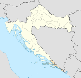
Babino Polje is the main town on the island of Mljet in the Dubrovnik-Neretva County . The settlement is in the center of the island.
geography
The place is located on the elongated island roughly in the center, on the southernmost hill ( Mali Grad , 247 m ) between the port at Sovra (Собра) in the east and Ropa , or Blato in the west.
Culture
There are Catholic churches of St. Andrew , Michael , Johannes , Georg (Đurđ), Blasius (Vlaho), Josef and Paul as well as some chapels and a monument to King Tomislav .
economy
Here there are agriculture ( viticulture ) and tourism ( climbing ).
Famous pepole
- Nikola Stražičić (1924-2018), geographer
Individual evidence
- ↑ Babino Polje at geonames.org.
literature
- Antun Tonko Vojvoda: Mljet - Odisejev otok . Zagreb 1999. ISBN 953-97949-0-0 .
- Branko Kesić (Ed.): Otok Mljet. Ekološke i zdravstvene prilike . Zagreb 1989.
- Branimir Gušić: Otok Mljet. Naš novi nacionalni park. Antropogeografski pregled i kulturno histor. spomenici . Zagreb 1958.
