Baglung
| Baglung Nagarpalika बागलुंग नगरपालिका Baglung |
||
|---|---|---|
|
|
||
| Coordinates | 28 ° 16 '8 " N , 83 ° 35' 59" E | |
| Basic data | ||
| Country | Nepal | |
| Gandaki | ||
| District | Baglung | |
| ISO 3166-2 | NP-P4 | |
| height | 970 m | |
| surface | 18.4 km² | |
| Residents | 29,360 (2011) | |
| density | 1600 Ew. / km² | |
| Website | www.baglungmun.gov.np | |
| politics | ||
| Chief Executive Officer | Haridatta Kandel (October 2015) | |
| 11 wards | ||
|
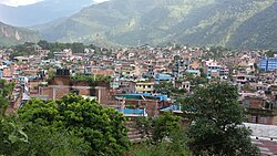
City center from a hill (2016)
|
||
Baglung ( Nepali बागलुंग ) is a city (municipality) in central Nepal and the administrative seat of the Baglung District in the Gandaki Province , about 72 kilometers by road west of Pokhara (37 kilometers as the crow flies).
The city is located on a terrace a good 200 meters above the Kali Gandaki and on the road from Pokhara to Jomsom .
The Kanthe Khola River flows into the Kali Gandaki on the left at Baglung. Baglung is the starting point for hikes in the Dhaulagiri area and upstream through the Kali Gandaki gorge to Mustang and the pilgrimage site of Muktinath .
Residents
At the 2011 census, the city of Baglung had 29,360 inhabitants (13,556 male) in 7,848 households.
Web links
Commons : Baglung - collection of pictures, videos and audio files
Individual evidence
- ↑ National Population and Housing Census 2011 (PDF) Central Bureau of Statistics. Archived from the original on July 31, 2013.

Baglung Bazar, Dhaulagiri in the background (2006)

