Baglung (district)
| बागलुङ जिल्ला Baglung District
|
|
|---|---|
 Location of the Baglung District (red) in Nepal |
|
| Basic data | |
| Country | Nepal |
| province | Gandaki |
| Seat | Baglung |
| surface | 1784 km² |
| Residents | 268,613 (2011 census) |
| density | 151 inhabitants per km² |
| ISO 3166-2 | NP-P4 |
| VDCs and cities (blue) in Baglung | |
Coordinates: 28 ° 21 ' N , 83 ° 16' E
The district Baglung ( Nepali बागलुङ जिल्ला ) is one of 77 districts in Nepal .
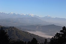
It is part of the Dhaulagiri Administrative Zone in the West Development Region . The district includes the mountainous country south of the Dhaulagiri massif and extends south of the Myagdi Khola and west of the Kali Gandaki . The administrative seat is in the city of Baglung .
Administrative division
Cities (municipalities) in Baglung District:
Village Development Committees (VDCs) in Baglung District:
- Adhikarichaur
- Amalachaur
- Amarbhumi
- Argal
- Arjewa
- Baskot
- Batakachaur
- Bhakunde
- Bhimgithe
- Bhimpokhara
- Bihunkot
- Binamars
- Boharagaun
- Bowang
- Bungadovan
- Burtibang
- Chhisti
- Daga Tundada
- Damek
- Darling
- Devisthan
- Dhamja
- Dhullu Jaidi
- Dhullubaskot
- Dudilavati
- Gwalichaur-Harichaur
- Hatiya
- Heela
- Hudgishir
- Jabdi
- Jaljala
- Kandebas
- Khungkhani
- Khunga
- Kusmishera
- Lekhani
- Malika
- Malma
- Mulpani
- Narayansthan
- Narethanti
- Nisi
- Paiyunthanthap
- Palakot
- Pandavkhani
- Paiyunpata
- Rajkut
- Ranasingkiteni
- Rangkhani
- Rayadanda
- Resha
- Righa
- Salyan
- Sarkuwa
- Singana
- Sisakhani
- Sukhaura
- Sunkhani
- Taman
- Tangram
- Tare
- Tityang
Web links
Commons : Baglung District - Collection of pictures, videos and audio files
Individual evidence
- ↑ Central Bureau of Statistics, Census 2011: National Report (pp. 51–52, Population Total and Area in Sq. Km ). ( Memento from May 25, 2013 in the Internet Archive ) (PDF; 7.8 MB)


