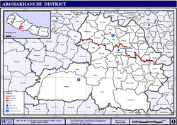
Arghakhanchi
| अर्घाखाँची जिल्ला Arghakhanchi District
|
|
|---|---|
 Location of the Arghakhanchi district (red) in Nepal |
|
| Basic data | |
| Country | Nepal |
| province | Province No. 5 |
| Seat | Sandhikharka |
| surface | 1193 km² |
| Residents | 197,632 |
| density | 166 inhabitants per km² |
| ISO 3166-2 | NP-P5 |
| Website | www.ddcarghakhanchi.gov.np |
| Area and population according to the 2011 census | |
| VDC in Arghakhanchi | |
Coordinates: 27 ° 57 ' N , 83 ° 4' E
The district arghakhanchi district ( Nepali अर्घाखाँची जिल्ला arghakhanchi district Jilla ) is one of 77 districts in Nepal and has been part of the Constitution of 2015 for Province No. 5, .
It had a population of 180,884 at the 1991 census, 208,391 in 2001 and 197,632 in 2011. Two thirds of the district area is in the area of the Mahabharat , one third in the Siwaliks .
history
The naming was based on two principalities, Argha and Khanchi , which existed until the annexation by the Kingdom of Gorkha in 1786. They belonged to the group of the so-called Chaubisi Rajya , twenty-four principalities that existed in the Gandak catchment area in this region.
Administrative division
Cities ( municipalities ) in Arghakhanchi District:
Gaunpalikas (municipalities):
Web links
Individual evidence
- ↑ Schedule-4 States, and Districts to be included in the concerned States. - Nepal Law Commission. Retrieved December 13, 2018 .
- ↑ Central Bureau of Statistics, Census 2011: National Report (pp. 51–52, Population Total and Area in Sq. Km ). ( Memento from May 25, 2013 in the Internet Archive ) (PDF; 7.8 MB)
