Bhaktapur (District)
| Bhaktapur District | |
|---|---|
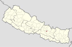
 Location of the Bhaktapur district (red) in Nepal |
|
| Basic data | |
| Country | Nepal |
| province | Bagmati |
| Seat | Bhaktapur |
| surface | 119 km² |
| Residents | 304,651 (2011 census) |
| density | 2560 inhabitants per km² |
| ISO 3166-2 | NP-P3 |
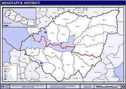
| VDCs and cities (blue) in Bhaktapur | |
Coordinates: 27 ° 41 ′ N , 85 ° 27 ′ E
The Bhaktapur district is the smallest district in terms of area in the Bagmati administrative zone in Nepal .
It has an area of 119 km² and a population of 304,651 (2011). The administrative seat is the city of the same name Bhaktapur .
Residents
The following table shows the development in terms of inhabitants per square kilometer, the total number of households in the city and the average number of people per household.
| year | 1971 | 1981 | 1991 | 2001 | 2011 |
|---|---|---|---|---|---|
| Population density |
830.68 | 1,342.58 | 1,453.38 | 1,894.63 | 2,560.09 |
| Number of households |
18,908 | 25,047 | 28,160 | 41,253 | 68,636 |
| Inhabitants per household |
5.83 | 6.38 | 6.14 | 5.47 | 4.44 |
Administrative division
The following cities are in the district of Bhaktapur :
All Village Development Committees in the Bhaktapur District were merged into newly founded cities as part of the community reform at the end of 2014.
Web links
Commons : Bhaktapur District - Collection of images, videos and audio files
Individual evidence
- Nepal at statoids.com (English)
- Statistical data from the UN ( Memento from January 7, 2009 in the Internet Archive )
- ↑ Central Bureau of Statistics, Census 2011: National Report (pp. 51–52, Population Total and Area in Sq. Km ). ( Memento from May 25, 2013 in the Internet Archive ) (PDF; 7.8 MB)
