Sindhuli
| सिन्धुली जिल्ला Sindhuli district
|
|
|---|---|
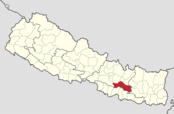
 Location of the Sindhuli district (red) in Nepal |
|
| Basic data | |
| Country | Nepal |
| province | Bagmati |
| Seat | Kamalamai |
| surface | 2491 km² |
| Residents | 296,192 (2011 census) |
| density | 119 inhabitants per km² |
| ISO 3166-2 | NP-P3 |
| VDCs and cities (blue) in Sindhuli | |
Coordinates: 27 ° 15 ' N , 85 ° 58' E
The Sindhuli District ( Nepali सिन्धुली जिल्ला ) is a district in Nepal .
The Sindhuli District is part of the Janakpur Administrative Zone in the Central Development Region . In 2001 the district had 279,821 inhabitants; In 2011 there were 296,192.
Administrative division
Cities in Sindhuli District:
Village Development Committees (VDCs) in Sindhuli District:
- Amale
- Arun Thakur
- Bahuntilpung
- Balajor
- Baseshwar
- Bastipur
- Belghari
- Bhadrakali
- Bhiman
- Bhimeshwar
- Bhimsthan
- Bhuwaneshor Gwaltar
- Bitijor Bagaincha
- Dadiguranshe
- Dudbhanjyang
- Hariharpur Gadhi
- Harsahi
- Hat sponsor
- Jalkanya
- Jarayotar
- Jhangajholi Ratmata
- Jinakhu
- Kakur Thakur
- Kalpabrishykha
- Kapilakot
- Khang Sang
- Kholagaun
- Kuseswor Dumja
- Kyaneshwar
- Lampantar
- Mahadevdada
- Mahadevsthan
- Mahendrajhayadi
- Majuwa
- Netrakali
- Nipane
- Purano Jhangajholi
- Ranibas
- Ranichauri
- Ratamata
- Ratnachura
- Ratnawati
- Santeswari
- Siddheswari
- Sirthouli
- Sitalpati
- Solpathana
- Sunam Pokhari
- Tamajor
- Tinkanya
- Tosramkhola
- Tribhuvan Ambote
Web links
Commons : Sindhuli District - Collection of images, videos and audio files
Individual evidence
- ↑ General Bureau of Statistics, Kathmandu, Nepal, Nov. 2012
- ↑ Central Bureau of Statistics, Census 2011: National Report (pp. 51–52, Population Total and Area in Sq. Km ). ( Memento of the original from April 18, 2013 in the Internet Archive ) Info: The archive link was inserted automatically and has not yet been checked. Please check the original and archive link according to the instructions and then remove this notice. (PDF; 7.8 MB)
