Zellerndorf – Sigmundsherberg railway line
| Zellerndorf – Sigmundsherberg | |||||||||||||||||||||||||||||||||||||||||||||||||||||||||||||
|---|---|---|---|---|---|---|---|---|---|---|---|---|---|---|---|---|---|---|---|---|---|---|---|---|---|---|---|---|---|---|---|---|---|---|---|---|---|---|---|---|---|---|---|---|---|---|---|---|---|---|---|---|---|---|---|---|---|---|---|---|---|
|
Pulkau train station (Photo: 2008)
| |||||||||||||||||||||||||||||||||||||||||||||||||||||||||||||
| Route number (ÖBB) : | 187 01 | ||||||||||||||||||||||||||||||||||||||||||||||||||||||||||||
| Route length: | 19.8 km | ||||||||||||||||||||||||||||||||||||||||||||||||||||||||||||
| Gauge : | 1435 mm ( standard gauge ) | ||||||||||||||||||||||||||||||||||||||||||||||||||||||||||||
| Maximum slope : | 17 ‰ | ||||||||||||||||||||||||||||||||||||||||||||||||||||||||||||
| Minimum radius : | 284 m | ||||||||||||||||||||||||||||||||||||||||||||||||||||||||||||
| Top speed: | 60 km / h | ||||||||||||||||||||||||||||||||||||||||||||||||||||||||||||
|
|||||||||||||||||||||||||||||||||||||||||||||||||||||||||||||
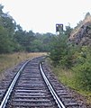
The Zellerndorf – Sigmundsherberg railway line (also known as the Pulkautalbahn ) is a standard-gauge railway line in Lower Austria. It leads from Zellerndorf via Pulkau to Sigmundsherberg .
history
The line was part of the main network of the Austrian Northwest Railway and was opened on July 1, 1872. Originally, the route was intended as a strategic transit route, which is why it partly only led past the locations. Pulkau train station, for example, is around three kilometers outside the city, and the Röschitz stop and charging point is also far away from the town. Another reason for the remote location of the stations was that the wagons , who provided the freight traffic from the station to the surrounding villages with ox-drawn carts , had generally spoken out against the construction of the railway.
On April 23, 1945, a serious accident occurred in Pulkau train station.
Passenger traffic on the entire route has been suspended since May 29, 1988, and all stops (with the exception of Pulkau train station) have been closed. On October 19, 1988, the Pulkau train station was also converted into an unoccupied stop; Until then, this was still occupied for the purpose of operating the hand-operated barrier. The remaining freight traffic on the Zellerndorf – Sigmundsherberg line was discontinued on May 31, 1990. This section of the route was used again and again for diversion trains because of track closures on the Franz-Josefs-Bahn - even after the regular passenger traffic was discontinued , so a gatekeeper was always employed at Pulkau station. There were also less frequent special trips; the last special train ran on May 21, 1998.
From 11th to 13th March 2003 and on 5th October 2005 derailment tests were carried out at Pulkau station with a short freight train and a measuring car. A new system was tested that reports derailed axles to the engine driver by means of a signal tone. Therefore, in order to get to Pulkau train station, the section from Sigmundsherberg to Pulkau was cleared of bushes and other undergrowth. However, the section to Zellerndorf was not restored, this has partly grown together beyond recognition. During the test drives, the railway station's track systems were damaged and not repaired.
Because in 2006 there was a lack of space in the former Vienna Südbahnhof due to track demolition, two Transalpin sets ( 4010 series ) and two Schlieren wagons were stowed in Pulkau station for a while.
On January 1, 2011, NÖVOG took over the line intended for abandonment from the ÖBB . NÖVOG handed over the line to the Waldviertel Railway Museum for reuse in June 2014 . As part of a study up until autumn 2014 it was ascertained whether the desolate stretch could be renovated and used for tourist purposes. In December 2018, an inquiry was sent to the Railway Museum regarding the current status of this study and its further progress. Because the estimated costs of reactivation are estimated to be too high, the mayor of Horner expressed the wish to convert the branch line into a cycle path. Contrary to this request, the Sigmundherberg Railway Association is still working on reactivating the line.
A special feature of this branch line is that the two entry signals to the Zellerndorf and Sigmundsherberg stations are still in operation. However, the entry signals in Pulkau station - these were form signals - have long been removed.
gallery
Stop board for the Röschitz stop ( can be seen in the Sigmundsherberg Railway Museum)
Individual evidence
- ↑ 23.04.1945: Train accident near Pulkau station (collision of transport train of sPzAbt 509 with clearing train) [1]
- ↑ Special trains: Special trains
- ↑ Derailment attempts: derailment attempts in Pulkau
- ↑ Transalpin set parked: 4010 scrap in Pulkau
- ^ The Franz Josefs-Bahn and its branch lines: barrier system in Seedeld-Kadolz and Tranalpin in Pulkau
- ^ District papers Hollabrunn: ÖBB sold 20 km of branch line
- ↑ A cycle path as an alternative to the Pulkautalbahn?
- ↑ Association equips route on Pulkautalbahn for trains
Web links
- Pictures from the route from February 24th 2010
- Track opening for cyclists? (Article no longer exists)
- Railways make your heads smoke (NÖN article from March 25, 2014)
- Course book 1944 route 462q
- Photos of the train stations Pulkau and Sigmundsherberg
- Photos of the Röschitz – Zellerndorf section
- One last time through the Pulkau valley
- Pulkau: Pinters “The Homecoming” in the old train station
- Photos of the Pulkau train station and the Rafing and Missingdorf stops
- BR 4010 in Pulkau (1/5)
- BR 4010 in Pulkau (2/5)
- BR 4010 in Pulkau (3/5)
- BR 4010 in Pulkau (4/5)
- BR 4010 in Pulkau (5/5)
- BR 2045.014 at Pulkau station
- Photo ride on a few meters of the Pulkautalbahn
- Precarious contract
- Query response on disused railway lines (page 3)
- Beaver plague along the Pulkau
- Discontinued railway lines in Lower Austria
- ÖBB 2045 in Hst. Röschitz (sometime in the 80s - date of recording unknown)
- Last scheduled trains on May 27, 1988 on the Pulkautalbahn
- Photos from Pulkau station ( photos taken on April 19, 2018)
- Pulkau train station ( photos taken on March 26, 2014)
- Route on openstreetmap.org


