Pangong Tso
| Pangong Tso | ||
|---|---|---|

|
||
| Geographical location | Ladakh (India), Tibet (PR China) | |
| Drain | → Shyok | |
| Data | ||
| Coordinates | 33 ° 43 ' N , 78 ° 54' E | |
|
|
||
| Altitude above sea level | 4238 m | |
| surface | 690 km² | |
| length | 134 km | |
| width | 8 kilometers | |
|
particularities |
salt lake |
|

|
||
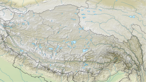
The Pangong Tsho ( Tib . : spang gong mtsho, mtsho mo ngang lha ring po, Tibetan སྤང་ གོང་ མཚོ ། མཚོ་ མོ་ ངང་ ལྷ་ རིང་ པོ , Pangong Tso ) is a salt lake in the 4238 m above sea level Highlands of Tibet on the border between India ( Ladakh ) and China (in the west of the Ngari administrative district , Tibet ).
Location and inhabitants
Two thirds of the lake, 134 km long and 8 km wide, is located on Chinese territory. It freezes over completely in winter. The lake covers about 690 km². 293.45 km² of this is in India. At the western end of the lake there is a drain to the Shyok . The Pangong Tsho can be reached from Leh, India via the Chang La mountain pass ( 5360 m above sea level). You need the Inner Line Permit for this. The first village, Spangmik, is the official starting point for most tourists. The film 3 Idiots from 2009 made the lake a magnet for film tourists and is therefore completely overcrowded. The negative influences from the masses of tourists are unfortunately already noticeable. The bird populations are changing, the fragile high-alpine ecology can no longer cope with the rubbish that has been left behind, and over 200 seepage toilets pollute the water. In Man , 10 km further, more upscale tourism is staying overnight. Very few make it to Merak , which is still almost spared from this type of tourism. Until Merak is also the end of the line for foreign tourists. Only local tourists are allowed to continue to Chushul . It is currently being examined whether the lake should come under the protection of the Ramsar Convention .
flora
The brackish water of the lake is free of micro-vegetation. Some types of shrub and perennial herbs grow in the swamps around the lake.
fauna
The Bar-headed Goose nests on Panggong Tso.
photos
| Tibetan name |
|---|
|
Tibetan script : སྤང་ གོང་ མཚོ ། མཚོ་ མོ་ ངང་ ལྷ་ རིང་ པོ
|
|
Wylie transliteration : spang gong mtsho, mtsho mo ngang lha ring po
|
|
Official transcription of the PRCh : Banggong Co
|
|
THDL transcription : Panggong Tso
|
|
Other spellings: Pangong Tso
|
| Chinese name |
|
Traditional :
班 公 錯 、 錯 木 昂拉仁波
|
|
Simplified :
班 公 错 、 错 木 昂拉仁波
|
|
Pinyin : Bāngōng Cuò, Cuòmù'ánglārénbō
|
politics
As part of a Sino-Indian border dispute in the Himalayas, military tensions arose between China and India on the Pangong Tso as well as in the Doklam plateau 1,800 kilometers to the east.
Web links
Individual evidence
- ↑ a b c National Wetland Inventory and Assessment: High Altitude Himalayan Lakes (PDF 1.2 MB 24 pages) Space Applications Center, ISRO, Government of India. January 2011.
- ↑ a b c National Wetland Atlas: High Altitude Lakes Of India (PDF 94 MB 128 pages) Space Applications Center, ISRO, Government of India. Sept 2012.
- ↑ 3 Idiots and the Consequences
- ↑ Fredy Gsteiger: Struggle for supremacy: India and China - two tigers on the same mountain. In: srf.ch. June 2, 2018, accessed June 7, 2020 .
- ^ Theo Sommer: Five to eight / India and China: Cold War in the 21st Century. zeit.de, August 22, 2017, accessed June 7, 2020 .


