Baro (river)
|
Baro Upeno, Opeeno |
||
|
The Sobat river system |
||
| Data | ||
| location | In the southwest of Ethiopia South Sudan |
|
| River system | Nile | |
| Drain over | Sobat → White Nile → Nile → Mediterranean | |
| origin | Confluence of the Birbir and Geba rivers 8 ° 14 '29 " N , 34 ° 57' 38" E |
|
| Source height | 553 m | |
| confluence | with the Pibor to Sobat Coordinates: 8 ° 26 '6 " N , 33 ° 13' 9" E 8 ° 26 '6 " N , 33 ° 13' 9" E |
|
| Mouth height | 404 m | |
| Height difference | 149 m | |
| Bottom slope | 0.49 ‰ | |
| length | 306 km | |
| Catchment area | 41,400 km² | |
| Discharge at the Gambela A Eo gauge : 23,500 km² Location: 230 km above the estuary |
MNQ 1905-1959 MQ 1905-1959 Mq 1905-1959 MHQ 1905-1959 |
62 m³ / s 418 m³ / s 17.8 l / (s km²) 1130 m³ / s |
| Left tributaries | Gebba | |
| Right tributaries | Birbir | |
| Medium-sized cities | Gambela | |
| Small towns | Itang | |
| Navigable | in the flood season to Gambela | |
|
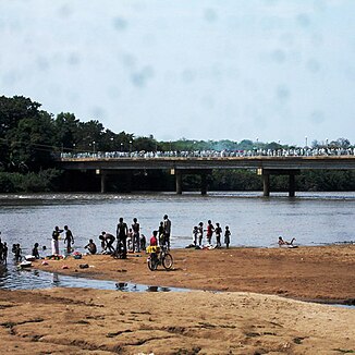
The Baro at Gambela |
||
The Baro ( Amharic ባሮ ወንዝ Baro Wenz , Anuak Upeno or Opeeno ) is a 306 km long river in the Gambela region in southwest Ethiopia .
course
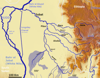
It is the main tributary of the Sobat , to which it joins the Pibor on the border to South Sudan . The catchment area covers around 41,400 km². Its headwaters are in the Ethiopian highlands . Its main tributaries are the Sor (tributary of the Birbir), the Gebba (also Geba), the Birbir and the Jikaw . It is navigable to Gambela during the flood season . The sobat gets about 72% of its water volume from the baro.
geography
The Baro gets most of its water from the Illubabor zone . For most of its course, it meanders through flat, wooded terrain with high amounts of precipitation at an altitude of around 400 to 500 m in a west-northwest direction. For the last 80 km or so it forms the border between South Sudan and Ethiopia. The river loses almost a quarter of its water between Gambela and the mouth in the Machar Marshes through evaporation.
Hydrometry
Average monthly flow of the Baro measured at the hydrological station in Gambela, about half of its catchment area, in m³ / s (1905–1959).

Individual evidence
- ↑ a b The Sobat Basin and the Machar Marshes. (PDF; 1.5 MB) Retrieved January 5, 2020 .
- ↑ Assessment of Benthic-Macroinvertebrate structures in relation to Environmental Degradation in some Ethiopian Rivers (page 26). (PDF; 703 kB) (No longer available online.) Archived from the original on June 6, 2014 ; Retrieved December 24, 2011 . Info: The archive link was inserted automatically and has not yet been checked. Please check the original and archive link according to the instructions and then remove this notice.
- ^ The Nile River (page 9). (No longer available online.) Archived from the original on December 3, 2011 ; Retrieved December 24, 2011 . Info: The archive link was inserted automatically and has not yet been checked. Please check the original and archive link according to the instructions and then remove this notice.

