
Bauang
| Municipality of Bauang | |||
| Location of Bauang in the province of La Union | |||
|---|---|---|---|

|
|||
| Basic data | |||
| Region : | Ilocos region | ||
| Province : | La Union | ||
| Barangays : | 39 | ||
| District: | 2. District of La Union | ||
| PSGC : | 013307000 | ||
| Income class : | 1st income bracket | ||
| Households : | 12,298 May 1, 2000 census
|
||
| Population : | 75.032 August 1, 2015 census
|
||
| Population density : | 1048 inhabitants per km² | ||
| Area : | 71.60 km² | ||
| Coordinates : | 16 ° 31 ′ N , 120 ° 19 ′ E | ||
| Area code : | +63 72 | ||
| Mayor : | Robert P. De Guzman | ||
| Geographical location in the Philippines | |||
|
|||

Bauang is a large municipality in the Philippine province of La Union and is located in the South China Sea . In Bauang, in contrast to other municipalities in the province, some people already work in industry or in the tourism sector. This is due, among other things, to the municipality's famous beaches and the relatively good infrastructure. Agriculture still plays an important role.
Population development
| year | Residents |
|---|---|
| 2000 | 63,373 |
| 2007 | 69,837 |
| 2010 | 70,735 |
Barangays
Bauang is in the following 39 barangays divided:
|
|
|
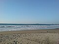
Bauang beach
