Beichlen
| Beichlen | ||
|---|---|---|
|
Beichlen in winter |
||
| height | 1770 m above sea level M. | |
| location | Canton of Lucerne , Switzerland | |
| Dominance | 4.6 km → valleys | |
| Notch height | 479 m ↓ Hilferenpass | |
| Coordinates | 640 723 / 194212 | |
|
|
||
The Beichlen , also called Beichle , is an elongated mountain ridge of the Emmental Alps in the Swiss canton of Lucerne .
location
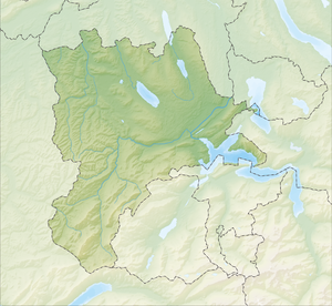
The ridge is located in Entlebuch , southeast of Escholzmatt . The communities Escholzmatt-Marbach and Flühli have a share in the ridge of the Beichlen .
The ridge of the Beichlen extends from the Hilferental in the south-west for around 7 km to the north-east to the Lammschlucht in the valley of the Waldemme . The main peak reaches a height of 1770 m above sea level. M. From here the height of the ridge will slowly but continuously until the Gsteigegg ( 1458 m above sea level. M. ) at the northeast end and the Rotefluespitz ( 1532 m above sea level. M. ) at the southwest corner. The Beichlen ridge is bounded in the west by the Ilfis valley , in the northwest and north by the broad valley of the Entlebuch and in the east by the Waldemme valley. Towards the south, the Hilferenpass ( 1290 m above sea level ) leads over to the Schrattenfluh chain . The Beichlengrat slopes steeply in all directions except towards the Hilferenpass.
etymology
The name Beichlen is probably derived from the word bank as a name for the rock banks ("Bänklen, Bänchlen, Bächlen, Bäichle").
geology
The Beichlen rocks come mainly from the lower freshwater molasses deposit period . In the period around 30 to 20 million years ago, numerous rivers transported large amounts of erosion material from the Alps , which were uplifting at that time, and deposited the rock fragments in the Molasse basin on the northern edge of the Alps. In the following time the Helvetic blankets were pushed over these molasses layers. As a result, the molasse near the edge of the Alps was compressed, lifted out and broken down into individual scales, which is why the formerly flat layers today form mountain ridges up to 1,800 m. The compressed and steep molasse of the Beichlen is called subalpine molasse in geology . The Beichlen is mainly made up of Nagelfluh , a conglomerate of rounded rock blocks of different sizes that are consolidated into a coherent rock with a binding agent (lime, sand and clay). Fine-grained sandstone and marl layers are also embedded between the Nagelfluh layers . During the Ice Ages, small kar glaciers formed on the northwest slope of the Beichlen. In historical times, several landslides and landslides occurred on the slopes of the Beichlen. The last major landslide, which began on June 22, 1980, even reached the valley floor of the Waldemme near Rohrigmoos.
flora
In the ridge area and on the southeast slope of the mountain ridge, there are larger alpine meadows and moor meadows. The steep slopes are mostly densely forested.
swell
- ↑ Erika Waser, Lucerne name book 1.1: Entlebuch. The place and field names of the Entlebuch office (A – L), Comenius, Hitzkirch 1996, ISBN 3-905286-56-4
Web links
- Geology and geomorphology of Beichlen and Entlebuch ( Memento from September 28, 2007 in the Internet Archive )
photos
The Beichlen seen from Escholzmatt before a summer thunderstorm.
The Beichlen seen from Escholzmatt in the sunset


