Bergambacht
 flag |
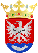
 coat of arms |
| province |
|
| local community | Krimpenerwaard |
|
Area - land - water |
16.95 km 2 16.11 km 2 0.84 km 2 |
| Residents | 5,185 (Jan 1, 2017) |
| Coordinates | 51 ° 56 ' N , 4 ° 47' E |
| prefix | 0182 |
| Postcodes | 2825, 2855, 2861 |
Bergambacht ( ) is a village and a former municipality in the Netherlands , province of South Holland . The villages Bergambacht, Ammerstol and Berkenwoude belonged to the municipality. On January 1, 2015, it was incorporated into the municipality of Krimpenerwaard .
Location and economy
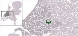
The community was located on the Lek about 25 km east of Rotterdam in the Krimpenerwaard polder. Most of the inhabitants lived from agriculture. There were some wood processing companies.
history
All three villages already existed in the Middle Ages . Ammerstol was even a town for some time ; it had received fish market and customs rights from the Count of Holland , but could not assert itself against more favorably located places. Several old farms still bear witness to a certain prosperity in the 18th and 19th centuries. Former Prime Minister Wim Kok was born in Bergambacht.
politics
Distribution of seats in the municipal council
| Political party | Seats | |||
|---|---|---|---|---|
| 1998 | 2002 | 2006 | 2010 | |
| Community concern | 4th | 5 | 5 | 5 |
| ChristenUnie / SGP | - | 3 | 3 | 3 |
| PvdA | 3 | 2 | 3 | 2 |
| VVD | 2 | 1 | 1 | 2 |
| CDA | 1 | 2 | 1 | 1 |
| SGP / RPF | 3 | - | - | - |
| total | 13 | 13 | 13 | 13 |
Web links
Individual evidence
- ↑ Kerncijfers wijken en buurten 2017 Centraal Bureau voor de Statistiek , accessed on June 2, 2018 (Dutch)
- ↑ Allocation of seats in the municipal council: 1998–2002 2006 2010 , accessed on June 2, 2018 (Dutch)
