Bernal (Mexico)
| Bernal | ||
|---|---|---|
|
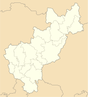
Coordinates: 20 ° 44 ′ N , 99 ° 56 ′ W Bernal on the map of Querétaro
|
||
| Basic data | ||
| Country | Mexico | |
| State | Querétaro | |
| Municipio | Ezequiel Montes | |
| City foundation | 1642 | |
| Residents | 3965 | |
| Detailed data | ||
| height | 2075 m | |
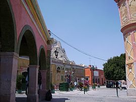
| Bernal town center | ||
| Bernal Rocks | ||
| Iglesia San Sebastian | ||
Bernal (also San Sebastián Bernal ) is a place with about 4,000 inhabitants in the Mexican state of Querétaro . Bernal belongs to the municipality of Ezequiel Montes and has been recognized as Pueblo Mágico since 2005 because of its colonial architecture .
location
Bernal is about 60 km (driving distance) northeast of Santiago de Querétaro on the southern edge of the Sierra Gorda at an altitude of about 2075 m above sea level. d. M. The climate is temperate and has little rain; the nights can be cold.
population
The region of Bernal was inhabited by the indigenous population of the Otomí people until the arrival of the Spaniards ( Conquista ) . Later, Spaniards and members of other Indian tribal groups joined them.
economy
The staple foods are corn and beans, but these are rarely grown in the arid environment. Instead, they have specialized in the cultivation of opuntia and wine , which get along well with the calcareous soils.
history
The traditions contradict each other in the founding date of Bernal: While one tradition reports that the place was founded in 1647 by Lieutenant Alonso Cabrera and his companion of ten soldiers and three of his sons, other traditions say that the place Bernal was founded in the year 1642 existed when 26 Spanish families were founded. With the arrival of the Spaniards, a military garrison was immediately established to protect against the attacking Chichimecs . In the 19th century, Bernal witnessed the French intervention in Mexico .
Attractions
- The village of Bernal is located at the foot of the approximately 8.7 million year old Peña de Bernal , which is the largest monolith in the world with a height of 433 m ( prominence 350 m) . The rock, which according to the local population has magical powers and is said to give a long life, is visited by several thousand tourists every year. On the occasion of each year in the spring held the feast of the day and night are equally long ( equinoccio ) traveling many people from the world to "let recharge new energy" with. The rock was inscribed on the list of the intangible cultural heritage of mankind by UNESCO in 2009 , along with other still-living traditions of the Otomí - Chichimecs .
- The place itself scores with its sometimes winding streets and its sometimes 200 or 300 year old houses, some of which are lined with arcades.
- Parts of a colonial administration building ( El Castillo ) were converted into a mask museum and a hotel.
- The St. Sebastian church dates from the early 18th century.
Web links
- Enciclopedia de los Municipios y Delegaciones de México: Municipio Ezequiel Montes, history etc. - Map, photos and information (Spanish)
- Bernal - Photos


