Biała (Dunajec)
|
Biała Biała Dunajcowa |
||
|
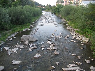
The Biała from the bridge in Grybów |
||
| Data | ||
| location | Poland | |
| River system | Vistula | |
| Drain over | Dunajec → Vistula → Baltic Sea | |
| source | north of the Lackowa Mountain in Gmina Uście Gorlickie 49 ° 25 ′ 49 ″ N , 21 ° 6 ′ 46 ″ E |
|
| Source height | 760 m npm | |
| muzzle | Northwest of Tarnów in the Dunajec Coordinates: 50 ° 2 ′ 14 " N , 20 ° 54 ′ 49" E 50 ° 2 ′ 14 " N , 20 ° 54 ′ 49" E |
|
| Mouth height | 196 m npm | |
| Height difference | 564 m | |
| Bottom slope | 5.5 ‰ | |
| length | 101.8 km | |
| Catchment area | 983.3 km² | |
| Left tributaries | Mostysz, Pławianka | |
| Right tributaries | Rzepianka | |
| Big cities | Tarnów | |
| Small towns | Grybów , Bobowa , Ciężkowice | |
The Biała is a right tributary of the Dunajec in the Lesser Poland Voivodeship in Poland .
geography
The river has its source north of the Lackowa Mountain, not far from the border with Slovakia in the Low Beskids ; the source height is given as 750–770 m. It then flows in a predominantly northern direction through the small towns of Grybów , Bobowa and Ciężkowice and further west past Tarnów and finally flows into the Dunajec in the northwest of Tarnów after a run of 101.8 km . The catchment area is given as 983.3 km².
Web links
Commons : Biała (dopływ Dunajca) - collection of images, videos and audio files
