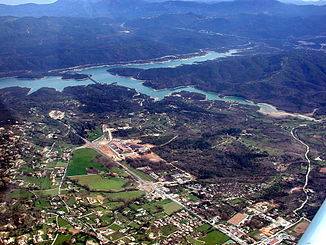
Biancon
|
Biançon Camiole |
||
|
Montauroux and the Lac de Saint-Cassien |
||
| Data | ||
| Water code | FR : Y5520500 | |
| location | France , Provence-Alpes-Cote d'Azur region | |
| River system | Siagne | |
| Drain over | Siagne → Mediterranean | |
| source | in the municipality of Mons 43 ° 39 ′ 54 ″ N , 6 ° 41 ′ 36 ″ E |
|
| Source height | approx. 688 m | |
| muzzle | in the municipality of Tanneron in the Siagne coordinates: 43 ° 36 ′ 37 ″ N , 6 ° 50 ′ 49 ″ E 43 ° 36 ′ 37 ″ N , 6 ° 50 ′ 49 ″ E |
|
| Mouth height | approx. 63 m | |
| Height difference | approx. 625 m | |
| Bottom slope | approx. 25 ‰ | |
| length | 25 km | |
| Catchment area | 161 km² | |
| Right tributaries | Riou Blanc | |
| Reservoirs flowed through | Lac de Saint-Cassien | |
| Small towns | Montauroux | |
The Biançon (also called Camiole in the upper reaches ) is a river in France that runs in the Var department in the Provence-Alpes-Côte d'Azur region . It rises near the hamlet of Tansonive , in the municipality of Mons , initially drains under the name Camiole towards the southeast, receives several star-shaped tributaries south of Montauroux , changes its name here to Biançon , crosses the Lac de Saint-Cassien reservoir , then turns to the northeast and flows into it after a total of 25 kilometers at the hamlet of Chapelle de Saint-Cassien des Bois , in the municipality of Tanneron , as a right tributary to the Siagne .
Places on the river
(Order in flow direction)
- Callian
- Montauroux
- Saint-Cassien des Bois , parish of Tanneron
Attractions
The valley in the mouth section of the river (below the reservoir) is registered under the name Gorges de la Siagne as a Natura 2000 protected area under the code FR9301574.
Web links
Individual evidence
- ↑ Source geoportail.gouv.fr
- ↑ estuary geoportail.gouv.fr
- ↑ a b Water information system Service d'Administration National des Données et Référentiels sur l'Eau (French) ( information ), accessed on February 9, 2014, rounded to full kilometers
- ↑ Information on the Natura 2000 protected area
