Big Rapids
| Big Rapids | ||
|---|---|---|
 Ferris State University in Big Rapids |
||
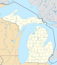
| Location in Michigan | ||
|
|
||
| Basic data | ||
| Foundation : | 1855 | |
| State : | United States | |
| State : | Michigan | |
| County : | Mecosta County | |
| Coordinates : | 43 ° 42 ′ N , 85 ° 29 ′ W | |
| Residents : | 10,601 (as of 2010) | |
| Population density : | 939 inhabitants per km 2 | |
| Area : | 11.6 km 2 (approx. 4 mi 2 ) of which 11.29 km 2 (approx. 4 mi 2 ) is land |
|
| Height : | 282 m | |
| Postal code : | 49307 | |
| Area code : | +1 231 | |
| FIPS : | 26-08300 | |
| GNIS ID : | 1619197 | |
| Website : | cityofbr.org | |
Big Rapids is a city ( City ) in the US state of Michigan . Big Rapids is the county seat of Mecosta County . In the 2010 census, Big Rapids had 10,601 inhabitants.
geography
Big Rapids is located in the western part of the Lower Peninsula ( Lower Peninsula of Michigan ), 130 km west of Saginaw , and 80 km north of Grand Rapids . The small town, 282 m above sea level, is traversed by the Muskegon River in a southerly direction. To the west of the city is the Manistee National Forest .
history
Big Rapids was founded in 1855 by George French and his brother Zera. Big Rapids has been a village and seat of Mecosta County since 1859 . Since 1869, Big Rapids has a town charter ( City ).
traffic
The US Highway 131 leads from Grand Rapids Coming north of Big Rapids over to Mackinaw City . Roben-Hood Airport is 3 kilometers northwest of the city .
education
The main campus of Ferris State University is located in Big Rapids .
