Bischbach (Main)
|
Bischbach Mühlbach |
||
|
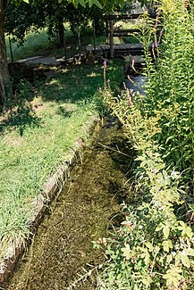
Bischbach above the Homburg paper mill |
||
| Data | ||
| Water code | DE : 245792 | |
| location | Bavaria | |
| River system | Rhine | |
| Drain over | Main → Rhine → North Sea | |
| source | northeast of Triefenstein - Homburg 49 ° 48 ′ 8 ″ N , 9 ° 38 ′ 28 ″ E |
|
| Source height | approx. 263 m above sea level NHN | |
| muzzle | in Homburg in the Main Coordinates: 49 ° 47 ′ 41 ″ N , 9 ° 37 ′ 11 ″ E 49 ° 47 ′ 41 ″ N , 9 ° 37 ′ 11 ″ E |
|
| Mouth height | 138 m above sea level NHN | |
| Height difference | approx. 125 m | |
| Bottom slope | approx. 52 ‰ | |
| length | 2.4 km | |
| Catchment area | 3.16 km² | |
| Communities | Triefenstein | |
The Bischbach , also called Mühlbach , is an almost 2.5 km long left and northeastern tributary of the Main on the Marktheidenfelder Platte on the edge of the Spessart Nature Park in Bavaria .
course
The stream, the upper valley of which is called the Hübschberggraben , rises northeast of the Triefenstein district of Homburg between the Lerchenberg and Hübschenberg plateau projections. On its course towards the south-west, it is closely followed by a road that descends from the county road MSP 42 through its valley to the state road 2299 in the Main valley. On the first half of its run it moves in open fields, often under vineyards on the left slope. Then it flows through Homburg, which lies in a small valley spider; It flows past the Museum Papiermühle Homburg and then continues largely piped. It finally crosses under the State Road 2299 and the Main Cycle Path before it flows into the Main.
See also
Web links
- Course of the Bischbach in the BayernAtlas on: BayernAtlas of the Bavarian State Government ( information )
- Catchment area of the Bischbach in the UmweltAtlas on: UmweltAtlas - basic data for flowing waters Bavarian State Office for the Environment ( information )
Individual evidence
- ↑ Source in the BayernAtlas (right click)
- ↑ Reservoir level of the Main between the Lengfurt and Eichel barrages. Estuary in the BayernAtlas (right click)
- ↑ a b Length and catchment area according to: Directory of stream and river areas in Bavaria - Main river area, page 150 of the Bavarian State Office for the Environment, as of 2016 (PDF; 3.3 MB) (accessed on July 25, 2017)
- ↑ BayernAtlas - the map viewer of the Free State of Bavaria. Retrieved June 30, 2017 .

