
Monchy-Breton
| Monchy-Breton | ||
|---|---|---|

|
|
|
| region | Hauts-de-France | |
| Department | Pas-de-Calais | |
| Arrondissement | Arras | |
| Canton | Saint-Pol-sur-Ternoise | |
| Community association | Ternois | |
| Coordinates | 50 ° 24 ' N , 2 ° 27' E | |
| height | 111-162 m | |
| surface | 3.37 km 2 | |
| Residents | 476 (January 1, 2017) | |
| Population density | 141 inhabitants / km 2 | |
| Post Code | 62127 | |
| INSEE code | 62580 | |

Monchy-Breton is a French commune with 476 inhabitants (at January 1, 2017) in Arrondissement Arras of the department of Pas-de-Calais . It is located in the canton of Saint-Pol-sur-Ternoise and is a member of the Ternois municipal association . Its inhabitants are called Monchois .
In the initial phase of the Second World War, there was a field airfield south of the town , which was initially used by the British Royal Air Force and later by the Luftwaffe during the western campaign of the German Wehrmacht . In the last week of May 1940, the 1st group of Jagdgeschwader 1 lay here and, at the beginning of May 1941, the 2nd group of Jagdgeschwader 3 , both of which were equipped with the Bf 109E .
| Brias | La Thieuloye | |
| Ostreville |
.svg)
|
Magnicourt-en-Comte |
| Marquay | Bailleul-aux-Cornailles |
Attractions
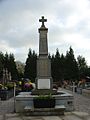
War memorial

Saint-Hilaire church


Web links
Commons : Monchy-Breton - Collection of images, videos and audio files