Warlencourt-Eaucourt
| Warlencourt-Eaucourt | ||
|---|---|---|

|
|
|
| region | Hauts-de-France | |
| Department | Pas-de-Calais | |
| Arrondissement | Arras | |
| Canton | Bapaume | |
| Community association | Sud-Artois | |
| Coordinates | 50 ° 5 ' N , 2 ° 47' E | |
| height | 92-128 m | |
| surface | 3.71 km 2 | |
| Residents | 138 (January 1, 2017) | |
| Population density | 37 inhabitants / km 2 | |
| Post Code | 62450 | |
| INSEE code | 62876 | |
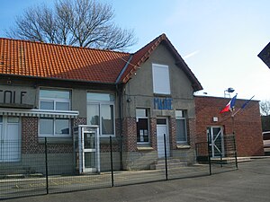
 Mairie Warlencourt-Eaucourt |
||
Warlencourt-Eaucourt is a commune in the French Pas-de-Calais in the region of Hauts-de-France . It belongs to the canton of Bapaume in the Arrondissement of Arras . It borders on Grévillers to the north, Ligny-Thilloy to the east, Le Sars to the south and Pys to the west . Warlencourt-Eaucourt is the lowest point in this canton at 118 meters above sea level .
Population development
| year | 1962 | 1968 | 1975 | 1982 | 1990 | 1999 | 2008 | 2013 |
|---|---|---|---|---|---|---|---|---|
| Residents | 110 | 102 | 85 | 84 | 81 | 107 | 151 | 160 |
Web links
Commons : Warlencourt-Eaucourt - collection of images, videos and audio files
