
Fleury (Pas-de-Calais)
| Fleury | ||
|---|---|---|

|
|
|
| region | Hauts-de-France | |
| Department | Pas-de-Calais | |
| Arrondissement | Arras | |
| Canton | Saint-Pol-sur-Ternoise | |
| Community association | Ternois | |
| Coordinates | 50 ° 25 ′ N , 2 ° 15 ′ E | |
| height | 86-131 m | |
| surface | 2.75 km 2 | |
| Residents | 122 (January 1, 2017) | |
| Population density | 44 inhabitants / km 2 | |
| Post Code | 62134 | |
| INSEE code | 62339 | |

Fleury is a French municipality with 122 inhabitants (at January 1, 2017) in Arrondissement Arras of the department of Pas-de-Calais . It is located in the canton of Saint-Pol-sur-Ternoise and is a member of the Ternois municipal association .
| Teneur , Érin | Anvin | Monchy-Cayeux |
.svg)
|
Hernicourt | |
| Bermicourt | Pierremont | Wavrans-sur-Ternoise |

Notre-Dame church
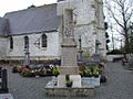
War memorial
_%C3%A9glise.jpg)

Web links
Commons : Fleury - collection of images, videos and audio files