
Séricourt
| Séricourt | ||
|---|---|---|

|
|
|
| region | Hauts-de-France | |
| Department | Pas-de-Calais | |
| Arrondissement | Arras | |
| Canton | Saint-Pol-sur-Ternoise | |
| Community association | Ternois | |
| Coordinates | 50 ° 18 ′ N , 2 ° 19 ′ E | |
| height | 79-145 m | |
| surface | 2.45 km 2 | |
| Residents | 54 (January 1, 2017) | |
| Population density | 22 inhabitants / km 2 | |
| Post Code | 62270 | |
| INSEE code | 62791 | |

Séricourt is a French municipality with 54 inhabitants (at January 1, 2017) in Arrondissement Arras of the department of Pas-de-Calais . It is located in the canton of Saint-Pol-sur-Ternoise and is a member of the Ternois municipal association .
| Nuncq-Hautecôte | Sibiville | |
.svg)
|
||
| Frévent | Bouret-sur-Canche |
Attractions

War memorial
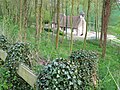
Saint Martin Church


Web links
Commons : Séricourt - collection of images, videos and audio files