Anvin
| Anvin | ||
|---|---|---|

|
|
|
| region | Hauts-de-France | |
| Department | Pas-de-Calais | |
| Arrondissement | Arras | |
| Canton | Saint-Pol-sur-Ternoise | |
| Community association | Ternois | |
| Coordinates | 50 ° 27 ' N , 2 ° 15' E | |
| height | 51-150 m | |
| surface | 7.83 km 2 | |
| Residents | 772 (January 1, 2017) | |
| Population density | 99 inhabitants / km 2 | |
| Post Code | 62134 | |
| INSEE code | 62036 | |
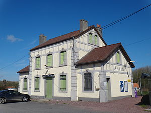
 Anvin station on the Saint-Pol-sur-Ternoise to Étaples line |
||
Anvin is a municipality in the north of France . It belongs to the Hauts-de-France region , the Pas-de-Calais department , the Arrondissement Arras and the canton of Saint-Pol-sur-Ternoise . The residents call themselves anvinois.
geography
The Route nationale 343 leads via Anvin.
The neighboring communities are Bergueneuse in the north, Heuchin in the northeast, Eps in the east, Monchy-Cayeux in the southeast, Fleury in the south and Teneur in the west.
Population development
| year | 1962 | 1968 | 1975 | 1982 | 1990 | 1999 | 2005 | 2014 |
|---|---|---|---|---|---|---|---|---|
| Residents | 604 | 615 | 587 | 639 | 666 | 741 | 833 | 778 |
Web links
Commons : Anvin - collection of images, videos and audio files
